In between the last trail (the Slí an Earagail in Donegal), and getting to Mayo we took a few days off - we both bought new boots, I celebrated a birthday, and we went to a couple of family events. While stopped I recorded a quick video of how we film and edit everything on the go, and we put out a short drone video of Lough Key and the amazing castle out on the lake.
But then it was time to get moving again….
County: Mayo
Official length: 124km
What we walked: 143km
Start point: Ballycastle
End point: Leenane
Trail difficulty: 4/5
Trail quality: 2.5/5
Views/area: 4/5
Camping/accommodation: this trail leads you through the most remote areas of Ireland, and doesn’t cross through villages or towns as often as most Irish hiking trails. There are a few points where you could be dropped and collected if you wanted to arrange with you accommodation, but otherwise camping is the only feasible option.
Maps: We’ve made our own Tough Soles maps! These maps are free to use, remix, and redistribute under CC-BY 4.0. All you need to do is attribute us! Here are the maps for the Western Way, and here are all the maps we’ve made.
Day 1: Ballina - Ballycastle (20+km)
It was only as we started this trail that we found thewesternway.ie, which has lots of resources for the trail: descriptions of each section of the trail along with distance, accommodation options, and links to official purchasable guide books.
What threw us a bit when we read the website however, was that it showed the trail starting in Bunnyconnellan, a village we’d never even heard of. We wondered if this was maybe the Foxford Way we had heard about after finishing the Sligo Way. We couldn’t be sure, and we didn’t really want to make a very long trail extremely long. We decided to mostly stick to the route mapped out by Irish Trails. We took a bus to Ballina, 32km before our official starting point of Ballycastle, loaded up on a lot of food supplies (read: very heavy bags), and started walking from there.
There was almost no waymarking, but it looked like there had been once upon a time, a long long time ago. That section of the walk was nearly 100% road (there was one beautiful forest section outside Ballina). Once we’d made it to Killala, we decided that was enough road walking and took a bus up to Ballycastle. The village of Killala itself was beautiful, I’d like to go go back some time and really explore it.
In Ballycastle you will find Burkes of Ballycastle; a newly opened, purpose built hostel. We were two of maybe three people staying there that night, and we chatted with the guy running it on and off all evening.

As per our usual level of planning, we spend that night laying out maps and figuring out where exactly we were aiming to get to, maybe where we could camp. I personally love folding the paper and linking all the sheets up together to build one long, detailed overview map. This one was the longest we’d built, and turned out to be longer than I was tall. We decided to laugh about it, instead of being intimidated by what lay ahead.
Day 2: Ballycastle - Ballecorick (32km)
The next morning a low, heavy mist is hanging around the village - not quite raining, but drenching everything within reach. Our host offers that we could stay an extra night and wait for some nicer weather, but we knew we needed to get some kilometres covered after taking our break.
We set off out of town, rain gear pulled up to our eyes, and turn off onto a small road.
On this small lane we come across a small girl and a woman. The girl has a look of deep concentration set across her face, as she gets onto the bike. She plants both feet firmly on the ground and nods to the woman, who counts to three and gives her the necessary push to get the wheels rolling. The feet jerk to an uneven rhythm as she tires to peddle, steer and balance at the same time. She makes it to the bottom of the slight down hill outside her house, turns too sharply and falls over. But there’s no tears as she picks everything back up and the woman jogs over to provide the pivotal push once more.
“We’ve no stabilisers today! And we’ve been out for four hours so far!” - we get a friendly, exhausted smile from the woman, and congratulate the girl on how well she’s doing. She clearly doesn’t need our support as she’s already ready to set off again.
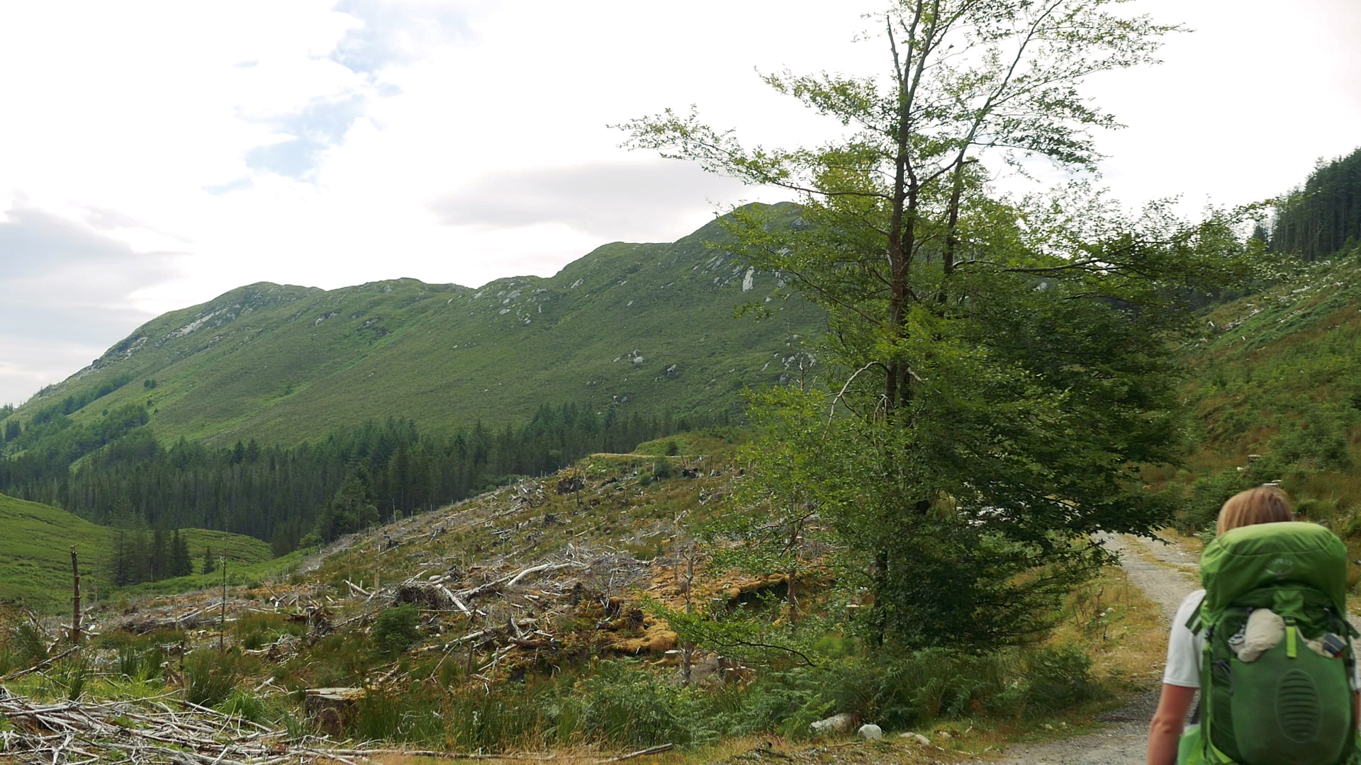
Not too long into the day we reached forest, and started our off road walking. Except … it wasn’t exactly what I’d call off road, as the trail followed newly chipped logging roads. I tried not to get too discouraged too quickly (if you’ve read a few of these blog posts you might know that I don’t like walking these forestry access roads), but as the day wore on the gravel persisted.
It was late afternoon when another niggle started pestering the back of my mind - I started to worry about my new boots.
I’ve not been the luckiest with boots; I fell in love with one specific model that was then discontinued, and the other pair that fit really well are a brand that aren’t really stocked in Europe. My newest boots were Scarpa Rangers, Gortex lined, heavy leather boots. I knew that they would be overkill for certain sections, but I really wanted something that would take a long time to wear through, and these boots were stiff enough that I could resole them once I’d worn down what was already there.
I’d done the usual recommended steps: worn the boots around the house, then around the garden, then pretty much lived in them for a week before bringing them out on the trail. The big difference between all of this and actually hiking - no weight. Without the 11+kg of my pack these boots were fine - I might even say great. However, with the added pressure of the pack my feet were slowly turning into a bruised mess. It didn’t help that the trail I thought was going to be the wildest in the country was so far only on hard ground.
We didn’t eat too much at lunch, just sat there, numb and tired in the still falling rain. We were trying to be a little more hopeful, as the logging road we were currently walking hadn’t been chipped any time recently, and there was a thin layer of moss in sections that at least made it feel like we were actually out in the wild.
The hiking gods must have seen our heavy hearts, as the next half an hour was pretty magical. We walked the longest section of boardwalk either of us had ever seen. We walked in the misty sunshine and felt a little better.
Sadly, when it ended we were back on the logging roads, and my heart sank once more. We had’t really talked about it all day (because we didn’t want to acknowledge the problem) but we also hadn’t seen anywhere good to camp in a long time. The ground was boggy, and wet, and whenever we camped on logging roads we risked tearing the bottom of our tent (never mind it always being the worst night sleep).
I did not want to be here, doing this, in so much pain. I’d never had boots hurt me like this before - I didn’t have any blisters, there was no chafing or cutting. There was just no give, no bend, no flex. At some point, I started crying while I was walking. I think I remember that I had been trying not to cry for a while, and I eventually was just too tired. So I walked and silently cried. The look of horror on Carl’s face when he turned around and saw my tear streaked face pulled me out of whatever daze I’d been blindly trudging through.
I took a couple of pain killers, and we looked at google maps. There was a large N road coming up, and 7km along it was a town - Bangor Erris. There was a B&B listed that had reviews from other walkers. We called.
Arriving at the N road we were extremely grateful that the host had offered to come and collect us, as this road too had just been chipped, and as the cars flew past we were pelted with the small sharp stones. We took a few steps back up the little lane we’d come down.
Back in the B&B I sat on the floor and gently massaged my feet. I rubbed some anti-inflammatory cream into them - something I’ve been carrying since I fractured my foot. That night there was a bone deep aching in my feet, but I was too exhausted to care.
Day 3: Ballecorick - Letterkeen Bothy (21km)
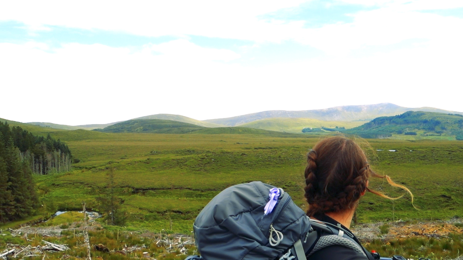
Our host dropped us back out to the trail the next morning, and as the morning passed the weather finally started to clear. Carl had taken some of our food out of my bag to ease the weight on my feet. I scheduled my pain killers. While the walking today was still all on forestry roads, it did bring us through some incredibly beautiful landscapes. Although every now and again we were pulled out of our reverie, as a car or van would drive past us. Where they would come from we had no idea, and where they were going we knew even less. But they were still around, even in these remote areas.
The closer we got to the Nephins the older the forests seemed. There was more than just the coniferous trees used for logging, but some native and deciduous trees mixed through. We followed a looping river down to an important dot we’d noticed on our map - the Letterkeen Bothy. Bothies are only something I learnt about since starting this project. From Scotland, a bothy is a small hut or cottage, originally for housing farm labourers or for use as a mountain refuge, they’re now wonderful shelters that hikers can stay in while crossing the emptier areas. This one here was possibly the only one we were going to come across while walking, and we really wanted to stay there.
When we arrived, we arrived to an overflowing car park. Not exactly the welcome we were expecting, so we went and found a picnic bench to wait at. I’d forgotten that it was a Saturday, and that other people would be taking to the hills. It was only mid afternoon when we arrived, and we were going to have a long wait if we wanted to stay there that night. An hour or so later most of the people arrived back together - a walking club. They were friendly and we chatted with people as they took off their own boots are relaxed. A short distance away, a small village of tents reassured us that it was normal for people to stay here (they had a pretty amazing set up: full sized barbecue, table and chairs, and at least two boxes of wine).
As the evening drifted on the car park slowly emptied out. While we waited I rubbed cream onto the few thousand midge bites I'd gotten since arriving in Mayo. The bites were dotted along my cheek bones, all over my ears, splattered on my hands, arms, everywhere. I wore my hat pulled down low not only to stop myself from being bitten more, but to stop myself from scratching.
The bothy itself was a small brick cottage, and inside was one large room with a concrete floor and fake fire place (so no toasting marshmallows tonight). There were some very nice looking campsites back up the trail beside the river, but we had made up our minds. Once it felt late enough we made laid out our gear and curled up. It wasn’t the best nights sleep - at midnight a car pulled up and parked with it’s lights shining in the windows. Two guys got out, talking as they walked over. They opened the door, saw us (no longer sleeping), turned around again and left.
Day 4: Letterkeen Bothy - Newport - Westport (28km)
We packed up early and started off towards Newport. There was some really nice off road sections during this sections, made all the better by a bit of sunshine. It was 13km into Newport, and we arrived for an early lunch. We claimed a table in the back garden on The Blue Bicycle, drank coffee and played chess. We took a few hours break, knowing that we had another 15km down to Westport. This next section was all along the Greenway - a huge cycle path linking Newport, Westport, and Achill Island.
It was nice to walk as we knew we were safe from the busy road traffic that we were often walking beside. The scenery was beautiful too. I’d probably recommend cycling the cycling path, enjoying all the beautiful views without having to spend hours slowly crawling though it. Some of the route runs along old train tracks, the banks on either side full of lush trees, and towering old bridges passing over head. I remember once seeing a map of all the train tracks that used to zig zag the country and wonder how many of those routes have become roads, or just swallowed up by the landscape.
Eventually we had Westport on our horizon. We turned off the cycle path and wound our way through a housing estate, to get to Westport House Campsite. It was a beautiful place, and after paying (and convincing the staff that we didn’t have a car hidden in our packs so we didn’t need to pay the extra parking fee) we found a fairly secluded corner of the camping area and pitched up. It was so nice to pile all our stuff in, take off our boots and feel the cool grass under our toes, knowing we didn’t have to move for the rest of the evening.
At this point both of us had burning feet. We hobbled to dinner, hobbled back, and fell into a deep sleep.
Day 5: Westport Rest Day
We took our rest day at Westport House Campsite. The place has very mixed reviews online. I could imagine it’s an expensive place if you have kids who want to do all the activities, but if you’re happy to just walk around the gardens it’s a pretty great place.
On our day off we met two with two amazing people - for breakfast we met Michael Quinn, who was soon to be setting off on the Ireland Way. It was great to sit down and compare some notes before he set off on his amazing adventure. As I write this he’s actually just finished. I hope we can meet up again some time in the future and compare notes now that the deed is done.
The second meet up that day was with the wonderful people of Leave No Trace Ireland. They’d read our blog post about The Unwritten Rules of Wild Camping and really liked it. That night we walked away official members of Leave No Trace Ireland. It was a pretty mind blowing rest day.
(Since then I’ve written another blog post about the 7 principles of Leave No Trace, and how important it is to protect the outdoors)
Carl reading at Westport House Campsite
Day 6: Westport - Derrymore (20km)
Since reaching Westport we started to meet more walkers coming against us, and walking out of Westport that sunny Tuesday morning we passed 6 hikers, who were all finishing their hike in Westport.
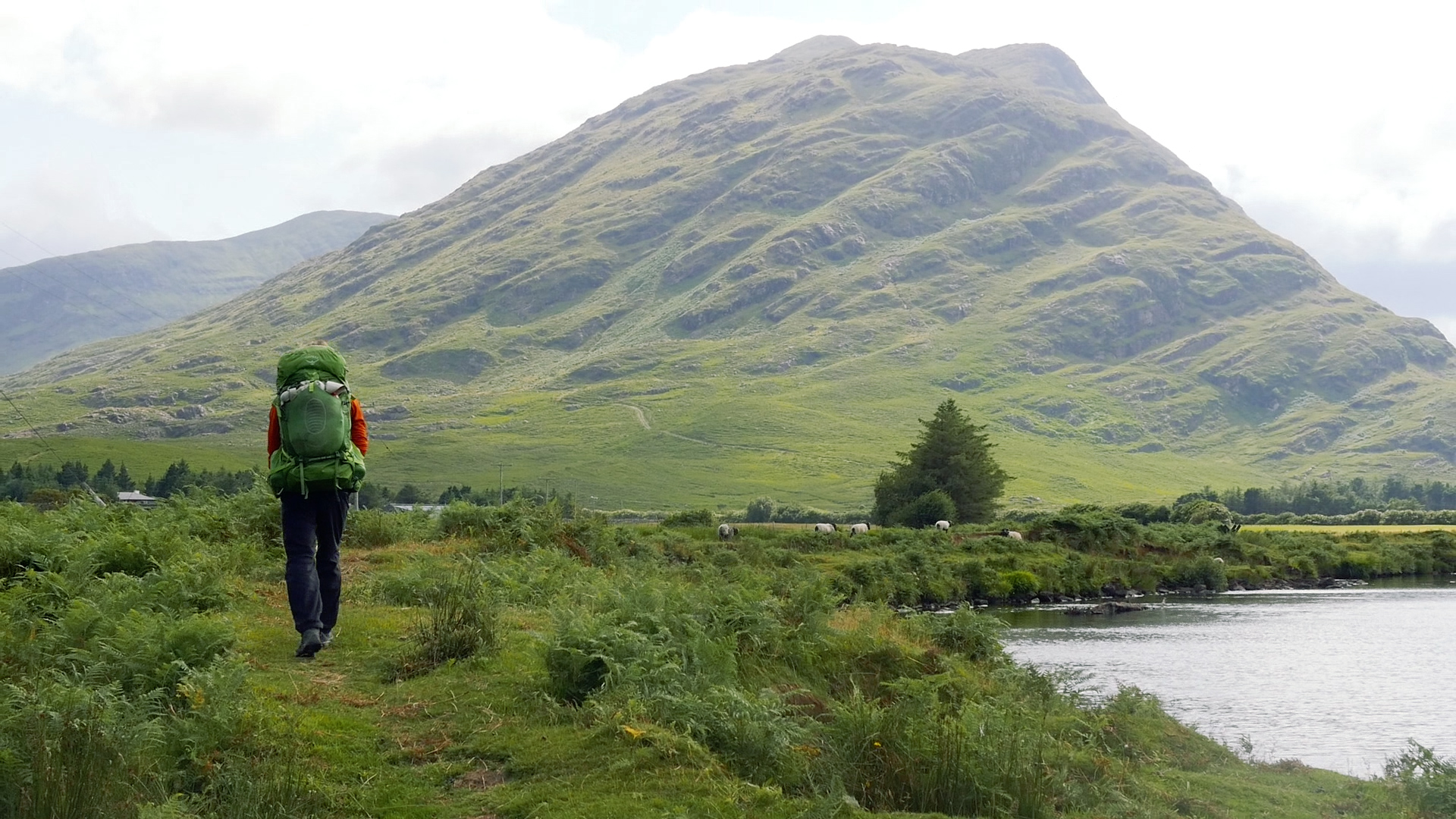
While still on hard surfaces, the walk is beautiful as it pings off the coast, finally leaving it for good as we reach Croagh Patrick. It’s on one of the small back roads around here that we cross paths with ourselves from almost 5 months ago. The Croagh Patrick Heritage Trail and the Western Way share the same trail for a while, and it’s nice to think back to when we walked the CPHT as part of their annual walking festival. We wind around the back of Croagh Patrick, and after a while more on roads cross onto forest tracks, and then get to spend some time fully off road, winding up and down many low hills. There are lakes strewn across the valley around us, and sometimes we climb high enough to see the sea again.
It’s not a long day, as back on the CPHT we’d met a woman who’d told us we could stay in one of her log cabins when we were passing through again on the Western Way. While in Westport I’d bought gel insoles for my shoes to try and cushion the soles of my feet a bit more. By the end of that first day the gel inserts were already showing signs of wearing. At least I wasn’t imagining the pain. Even slowing down and only aiming for 20km a day was suddenly pushing me to my limits.
Day 7: Derrymore - Leenane (21km)
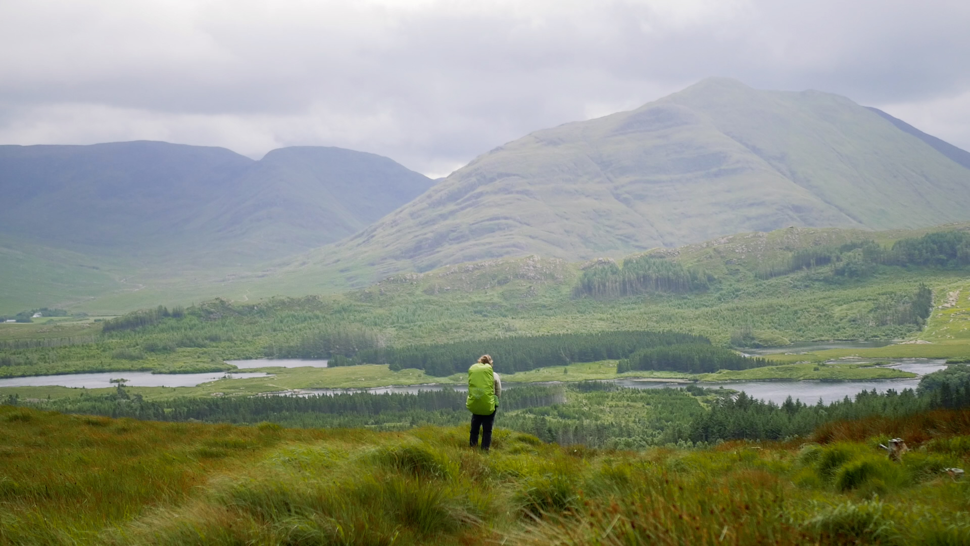
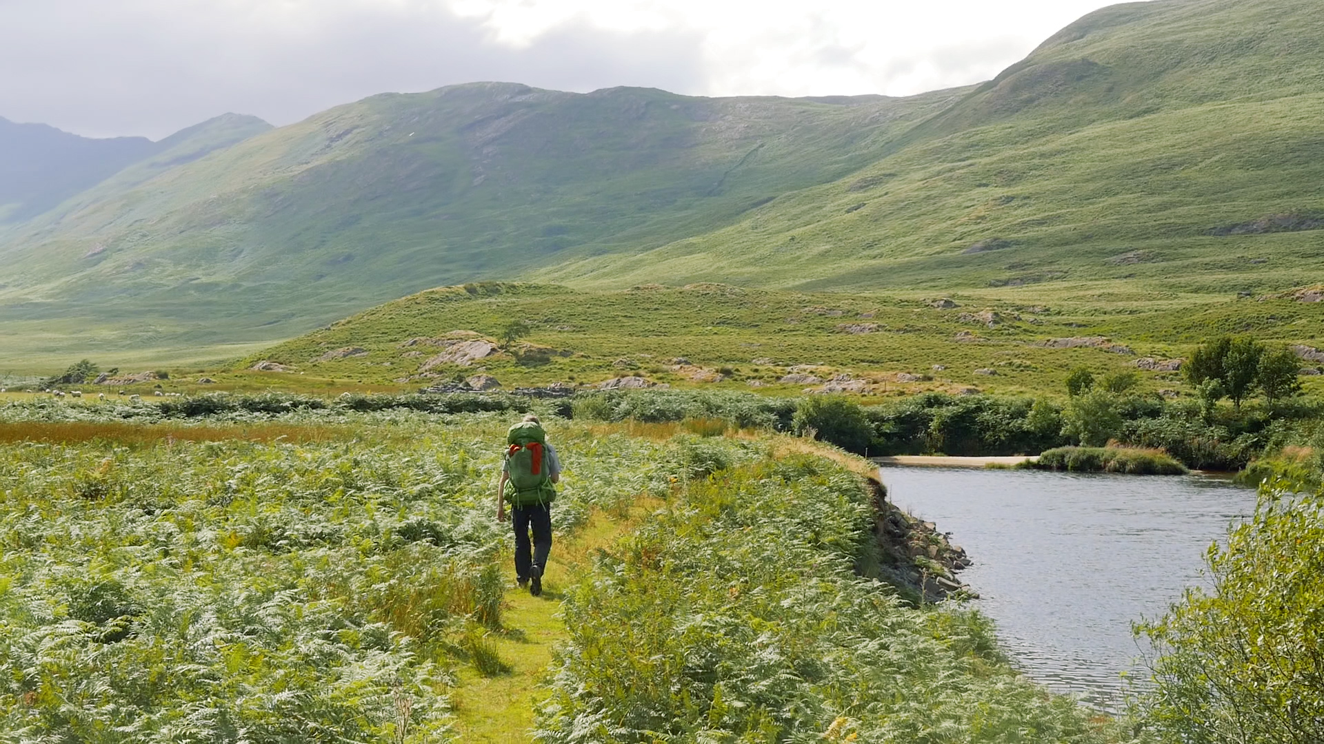
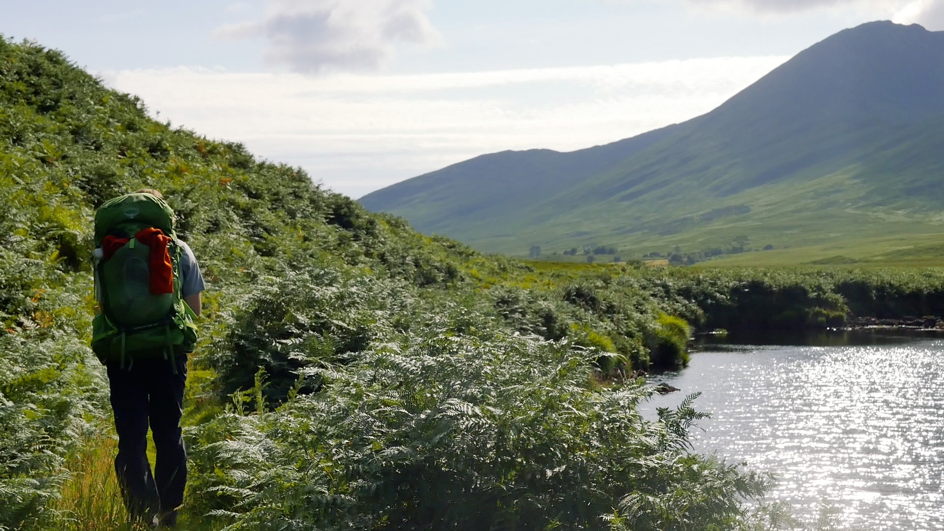
We leave the next morning in some light rain, and hit the roads. We cross the huge valley we’d entered the day before, and do a long climb up the other side. The view is breath-taking, and on the far side we leave the road for some open hillside! It’s incredibly beautiful, and slowly the sky clears to let us truly enjoy the views around us. We end up in a glacial valley, with huge erratic mountains all around us. I’d driven though these parts before, but clearly not along the right roads. It was incredible. I am possibly running out of positive adjectives.
Following a river bank I finally find my walking legs again - these boots are wonderful on soft ground! Carl’s legs aren’t so great, but we keep moving forwards. We pass Aasleagh Falls, which, with the general drought the whole country has been going through, are just a trickle. We meet some tourists walking out of Leenane asking us if the falls were far. They weren’t that far so we point them onwards, unsure if we should have told them how little water was there to admire.
Once back on roads again it’s back to hobbling. We reach Leenane and I am so glad to be finished for the day. There are lots of pubs, but none of them serve food. We buy several bags of crisps and sit outside munching. Looking online we spot a deal for somewhere indoors to stay just around the corner, and so we book it. We eat fruitcake and biscuits on the bedroom floor, and do some video editing before falling asleep.
Looking back at my photos from this trail there were some really beautiful sections. However my personal memory is scarred with searing foot pain, and so I don’t know how much I can really judge it. Certainly, the further south we went the better it got. With less on our backs it would probably be a much more enjoyable trail.
Also, from the Letterkeen Bothy there is access to another trail - the Bangor trail. For quite a while I thought it was the same as the western way, just a specific name for the northern section. Now, I know that it’s a different trail that finishes in Bangor-Erris, the town from day 2. Reading about this trail it seems a lot more “off-road” than the northern half of the Western Way, although that’s hard to know without having walked it yet. I know we say this a lot, but I think we definitely will go back and do the Bangor Trail, and we should probably do the Western Way again to see if my not-so-happy memories are right. At the time I definitely didn’t really like it, but I was expecting something much wilder, and less paved, than we experienced.
The next blog will be the Western Way Galway, from Leenane to Oughterard.
Irish Trails Overview Map
The Western Way Mayo video & the Western Way Galway Video for the impatient souls
If you like our blog you can subscribe to it here!
If you really like it, you can support us on Patreon