
Glendalough White Loop
The Glendalough White Route is a 9km looped trail that starts at the Upper Lake in Glendalough, taking you along the valley floor, through the Miner’s Village, up the top of the valley and across The Spinc boardwalk. Possibly one of Ireland’s most famous mountain valleys, Glendalough is an incredibly beautiful place to visit.

Overview
Distance: 9km
Time: 2 - 4hrs
Parking:
Upper Lake Car Park: here (closest to trail start)
Lower Lake Car Park: here (closest to Glendalough Monastic City)Trail difficulty: Easy
This trail is a hard, easy hike. Across this 9km you climb around 400m across varying terrain - the majority being rocky trail and raised boardwalk / bog bridges. While the route is clearly defined, and many people do it every single day, it’s in the mountains, quite exposed, and brings you along cliffs. So if you’re looking for a harder hike that is easy to follow, then this might be for you!
Learn more about trail and hillwalking grades here.Trail quality: 5/5
This trail is constantly maintained by the NPWS, as it’s one of the biggest attractions in this area of the Wicklow Mountains National ParkViews: 5/5
It’s famous for a reasonBuggy/Wheelchair friendly: No
Way-marking: White arrow
Toilets:
Upper Car Park Toilets
Lower Lake at the Glendalough Visitor CentreMaps:
Download my GPX of the route here
Find the route on Hiiker here
Download the route from the NPWS hereDogs allowed: On a lead (see Wicklow National Park’s infographic on the Code of Conduct for Dogs)
There are nine waymarked trails in Glendalough - all taking in different aspects and covering a variety of distances. But I think the most famous section of trail is the raised boardwalk known as “The Spinc” (named for the hilltop it skirts around). There are two trails that take in this boardwalk - the Red Route (11.5km) and the White Route (9km).
I chose the White Route as I wanted to take in the main valley of Glendalough Upper Lake - which you then get to look down on from the Spinc boardwalk later on in the hike. Personally, I prefer to do this trail anticlockwise from the visitor centre / front of the Upper Lake.
But for this outing, I actually parked near the lower lake car park and the Monastic City.
“In the latter part of the sixth century, St. Kevin crossed the mountains from Hollywood to Glendalough. Within 100 years, the area had become one of the most important monastic sites in Ireland, and it continued to flourish after St. Kevin’s death in 617 A.D”
- Wicklow Mountains National Park
Walking up from the Monastic City to the upper lake is straight forward - leaving the ruins by the narrow foot bridge, turn right and follow the undulating track along the side of the lower lake.


At the upper lake the info board for all the trails, and the first markers for this trail, are outside of the small white building that is home to the info centre.
From here you head around to the Miner’s Road, which runs along the north side of the lake. The road is closed to traffic, and the sand-coloured compacted gravel is reminiscent the mining that happened back in the 1800’s. This stretch is relaxing, raised slightly above the lakeshore and lined with scots pine, it twists gently with the folds of the valley wall.
One of the benefits of solo hiking is that you’re silence means you’ve better chances of seeing some of the countless deer that live in the mountains - although in Glendalough many of the deer there aren't as flight-ish as their cousins in other parts of Ireland. I spent a while standing on the path looking up at a group, while they stared down at me.


One of the trickier parts of valley hiking at this time of year (early January, and something I’d forgotten about until I arrived), is how short the window is where the sunlight reaches the valley floor. Having started my hike later than I’d originally planned (a little before noon), the sun started to set behind the southern wall of the valley while I was still walking along it.
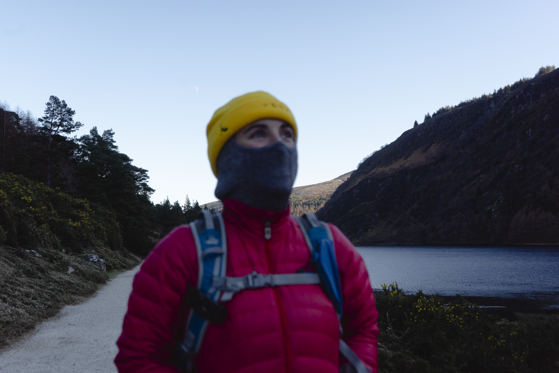
However, I’d chosen today to walk and film this trail that day as I knew the below-freezing temperatures would keep the crowds away (which it did) and I got to enjoy Wicklow with only a handful of other walkers. In preparation, I was on the trail with four layers, and pulled the built-in buff of one of my base layers up over my face to keep the chill off.


Not far from leaving the trees you then reach the Miner’s Village, the ruins of which you can explore through. I personally always love crossing along the large stones that are partially stepping stones through the shallow stream. It’s after the Miner’s Village that the main climbing of the day begins.
The only moment when I opened my down jacket for some brief airflow was on the clim at the end of the valley. Here’ the trail zig-zags it’s way up alongside the stream that feeds into the lake below. The trail since the Miner’s Village is rougher underfoot and narrows as you ascend the valley.
The stream is mostly frozen as I work my way along, with fresh water flowing and adding thin layers to the now glossy stones. After the doe’s I saw in the forest earlier, here I meet the stags, who are all more interested in finding whatever nutrients they can in the frozen grass, than even glancing at me.
I leave them to it and soon reach the narrow bridge over the top of the stream. This is the marker that I call the half way point in the trail.


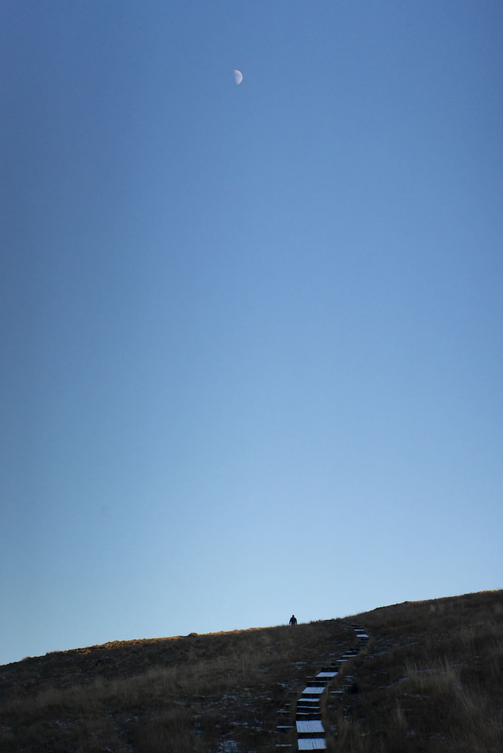


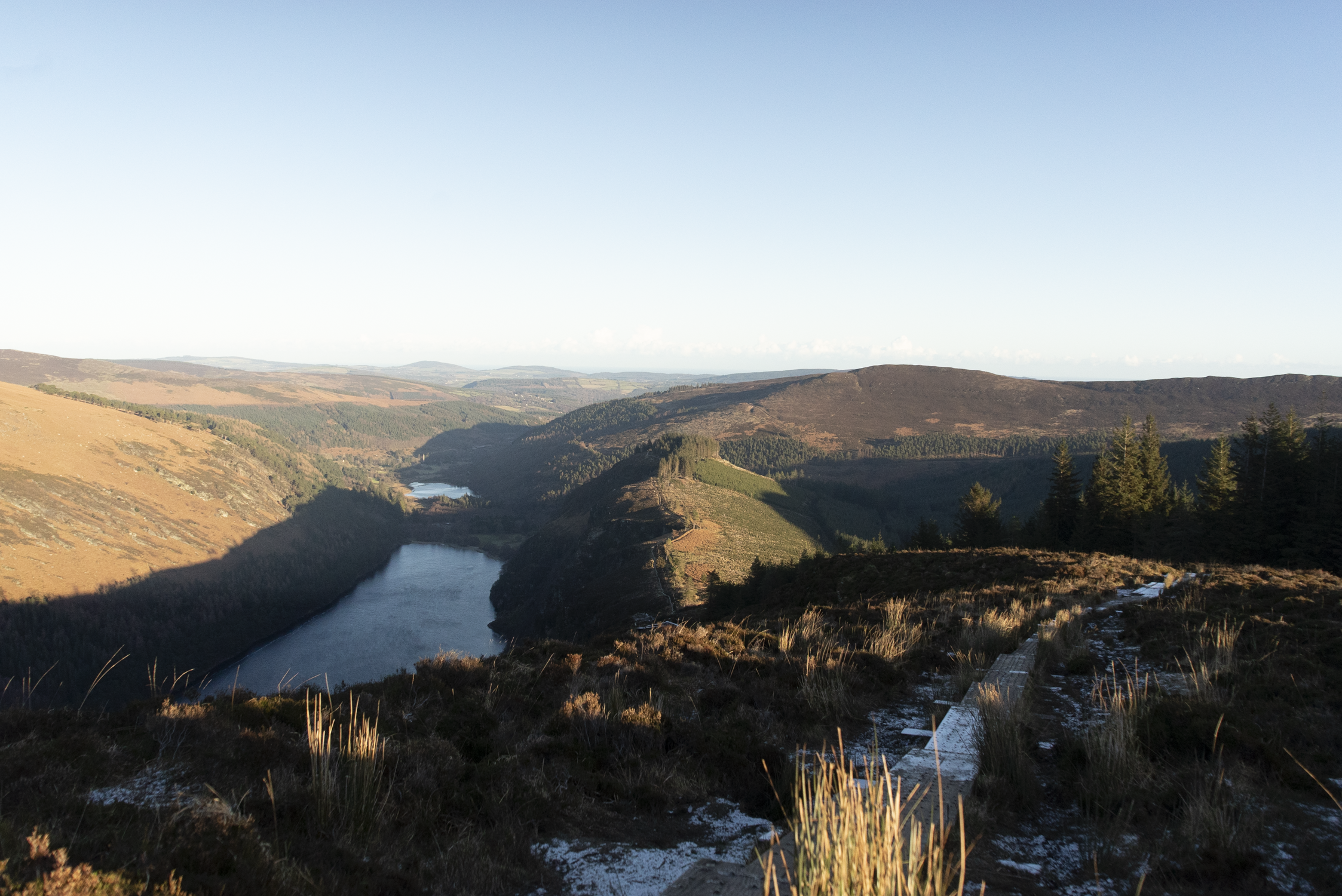
After the bridge the boardwalk (also known as bog bridge or railway sleepers) begins. From here there’s one more climb, and then it’s all beautiful views and gently undulating ascents and descents.
There are a couple of different view points along the Spinc board walk, all offering great sights and nice photo opportunities.
Once the rail way sleepers have been descending for a while, the trail turns back to compacted ground, and turns around the side of the hill to zig-zag back to the valley floor.


Here you’ll pass through different sections of forestry along access roads, with the trail taking some short cuts through the trees here and there.
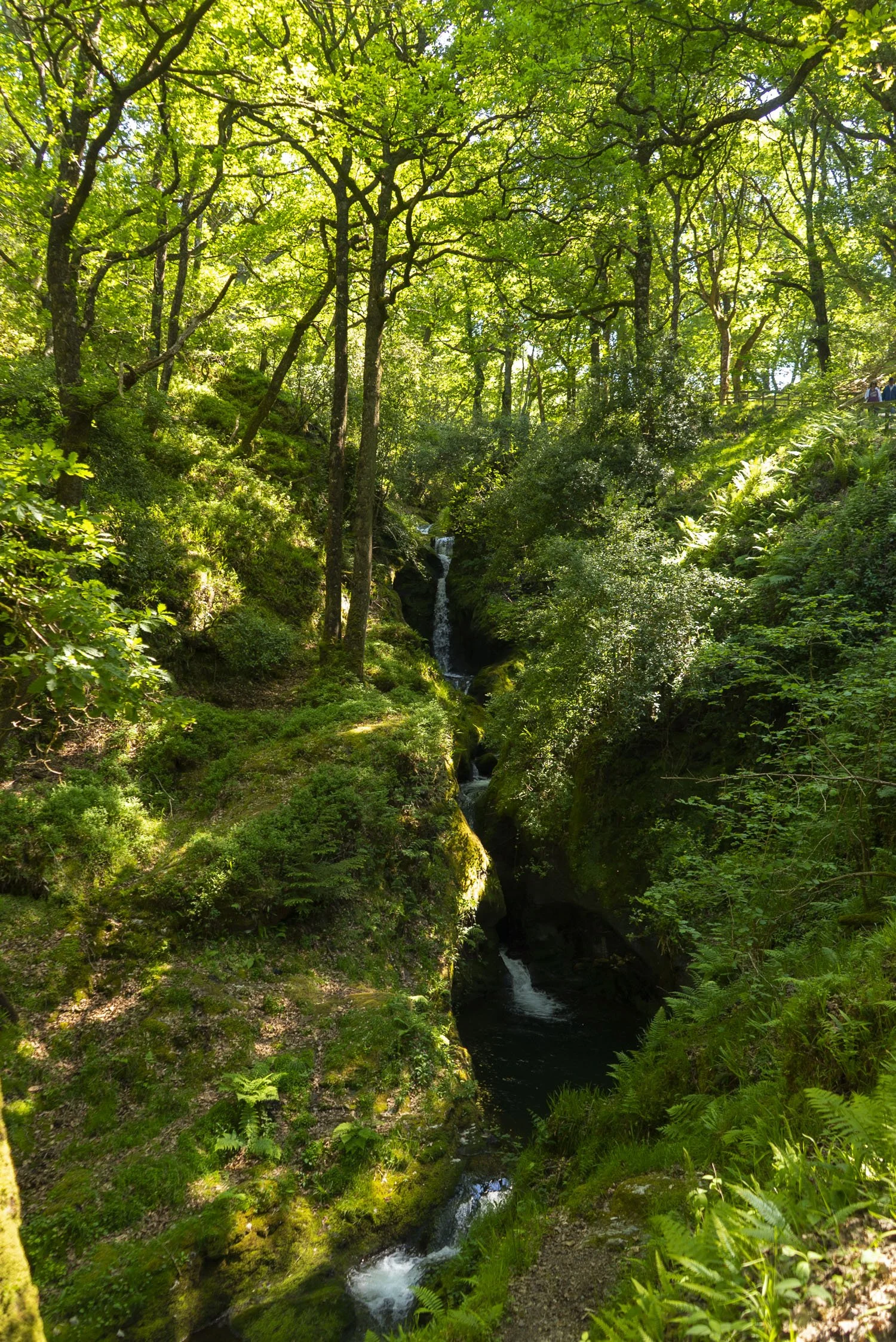
As you enter more native, mixed woodland, you’ll come to Poulanass Waterfall - which I’ve included a photo of below from a previous hike in the summer, when the world is a lot warmer and everything is alive.


Further exploring
Other trails in the area:
Mountain hikes:
Kippure: Dublin County High Point
Coffee/food options:
Glendalough Green Cafe, Laragh: a Wicklow institution, I’ve been going here since before I could walk! this is the perfect cafe for a cosy mocha on a winters day, or a coffee and sweet treat to take out into the sunshine of a summers day.
In the upper car park of Glendalough there are food trucks, and there are few things more satisfying than grabbing a bag of chips after a hike!