Overview
Distance: 6km
Time: 1 - 2 hrs (depending on route and fitness)
Parking:
Main Car Park: Slievenamon Walk Parking. Room for roughly 6 cars. Make sure to avoid blocking any passing traffic, farm vehicles and livestock.
Car Park B: Village ParkingTrail difficulty: Easy - Medium
The route up Slievenamon from the main car park isn’t way-marked, but it is clear to follow. The trail is rough and rocky in places, but not overly challenging for a mountain path. Read more about trail grades here.Trail quality: 5/5
This isn’t a maintained or official trail, so rating it on “quality” isn’t really applicable. However, it is a very nice route, with a bench a short climb up from the start.Views: 5/5
Slievenamon is a standalone mountain, and the views you get across the valleys to the Comeraghs, Galty’s and Knockmealdowns are great on a clear day.Buggy/Wheelchair friendly: No
This is an open mountain side, with rough terrain.Dogs allowed: No
The route up goes through farm land, so it’s not dog-friendlyExternal links:

Slievenamon (721m) is Tipperary’s most prominent standalone mountain. An Anglicisation of Sliabh na mBan, it directly translates as "mountain of the women". Personally, I’ve always internally translated it as the Women’s Mountain.
Whatever way your translation falls, the name is most commonly attributed to the folklore stories of Fionn Mac Cumhaill. According to legend, women all across Ireland wanted to win the hand of folklore hero Fionn Mac Cumhaill. To settle who would be his wife, Fionn declared that whoever won a race up to the summit would be his wife. However, we all know that Fionn was in love with Gráinne, and he showed her a short-cut, ensuring she would win.
Another locally claimed etymology for the name is that, at the right distance and angle, the mountain and surrounding foothills look like a woman lying down.

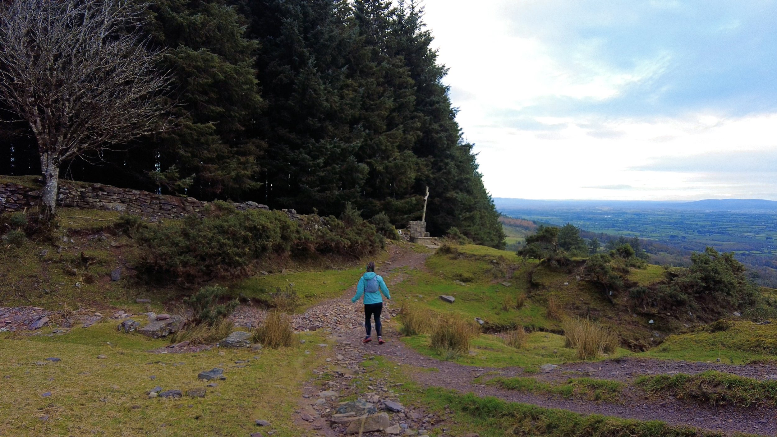
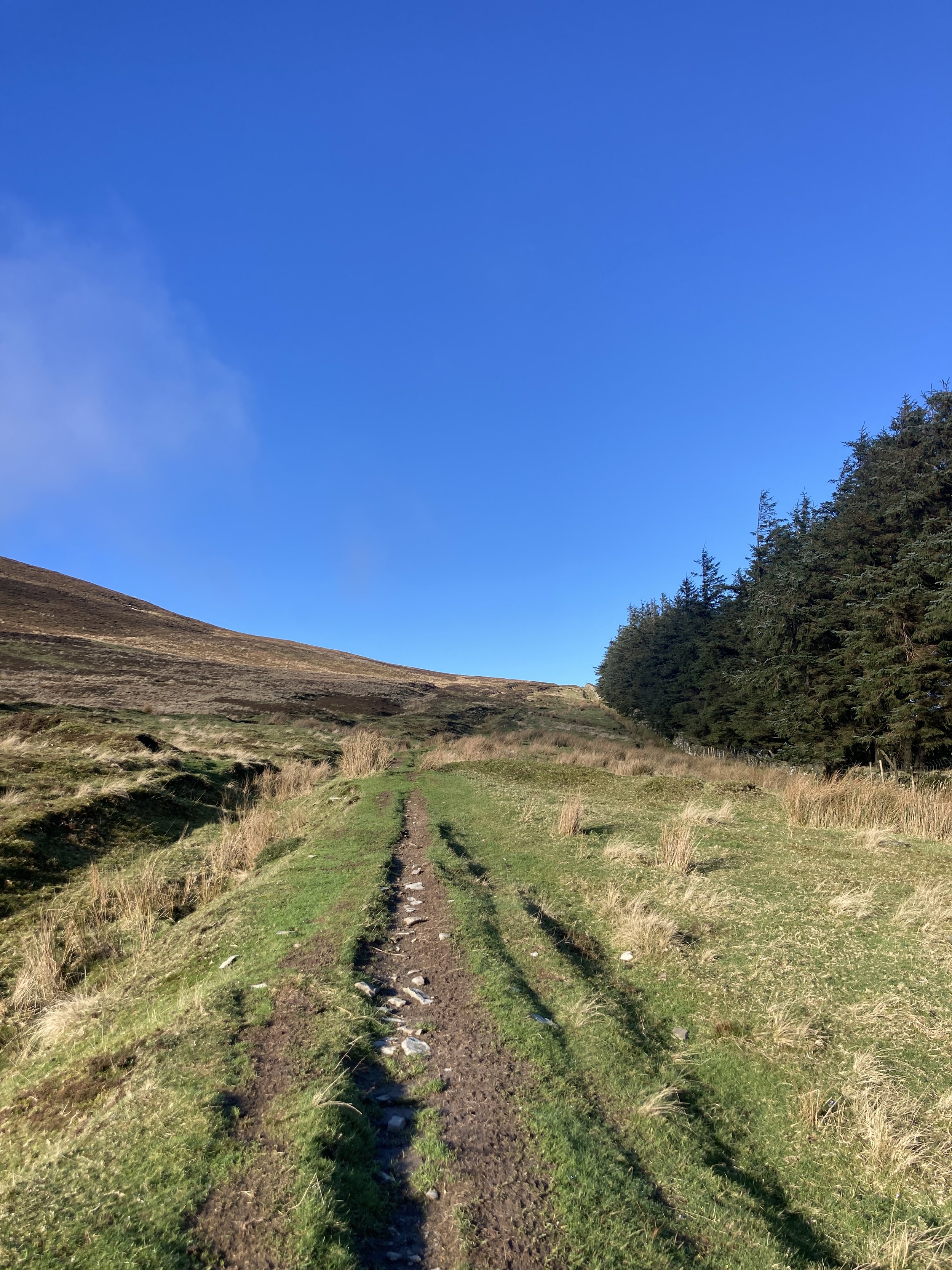
Starting from the small parking area beside the trail head, an info board on the route stands beside the tree-lined track that marks the start. Heading up this loose path, you’ll come to a set of farm gates (always close behind you), and from there you are onto the open mountain.
Making your way onto the open mountain, the trails tracks along the side of some forestry. A short stretch into this climb, you’ll come to a bench that offers gorgeous views out across the valley towards the Galty Mountains.


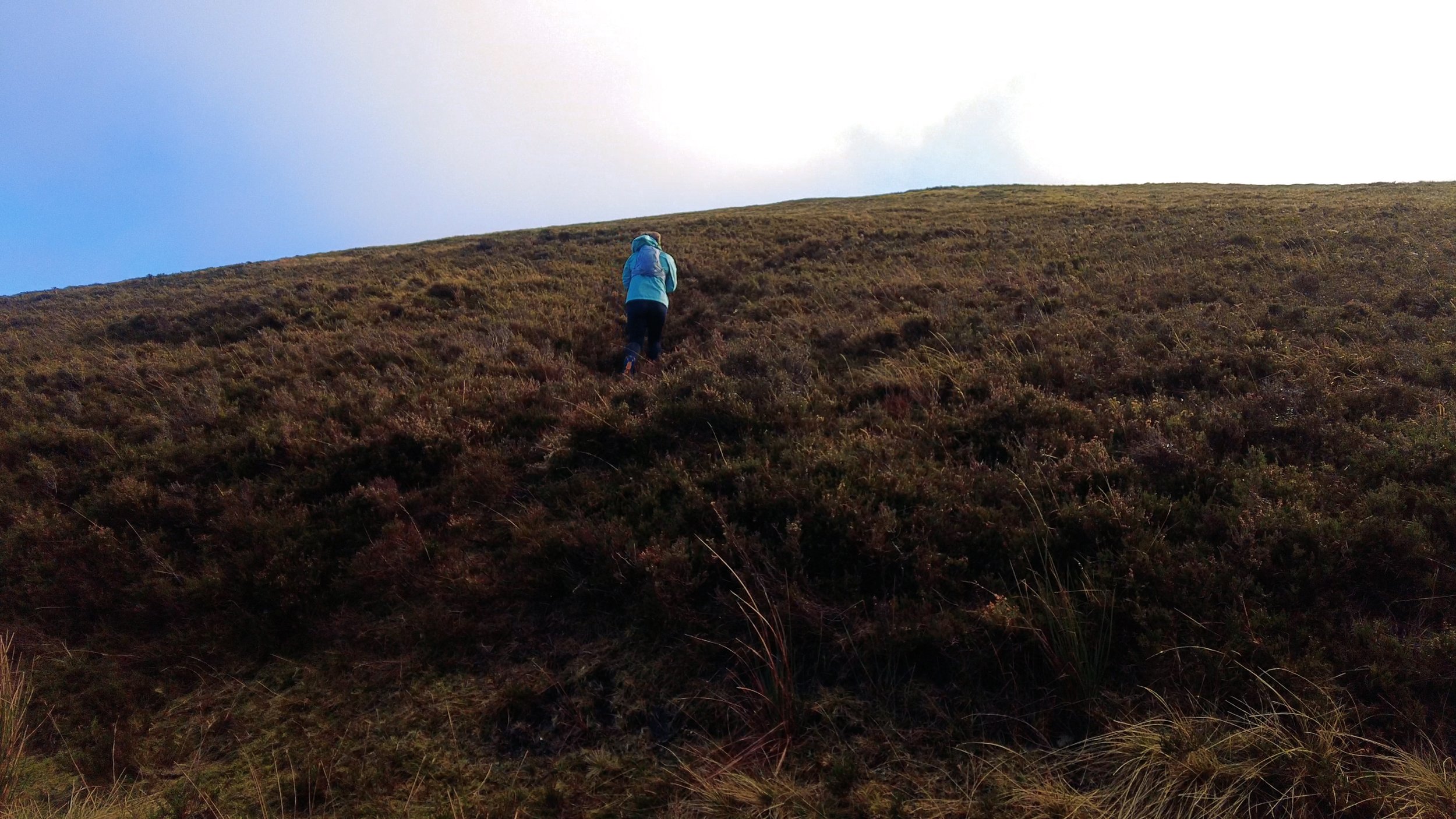
From here the trail steadily climbs up towards the summit. It’s a consistent gradient with loose stone underfoot, but the path is very clear to follow.
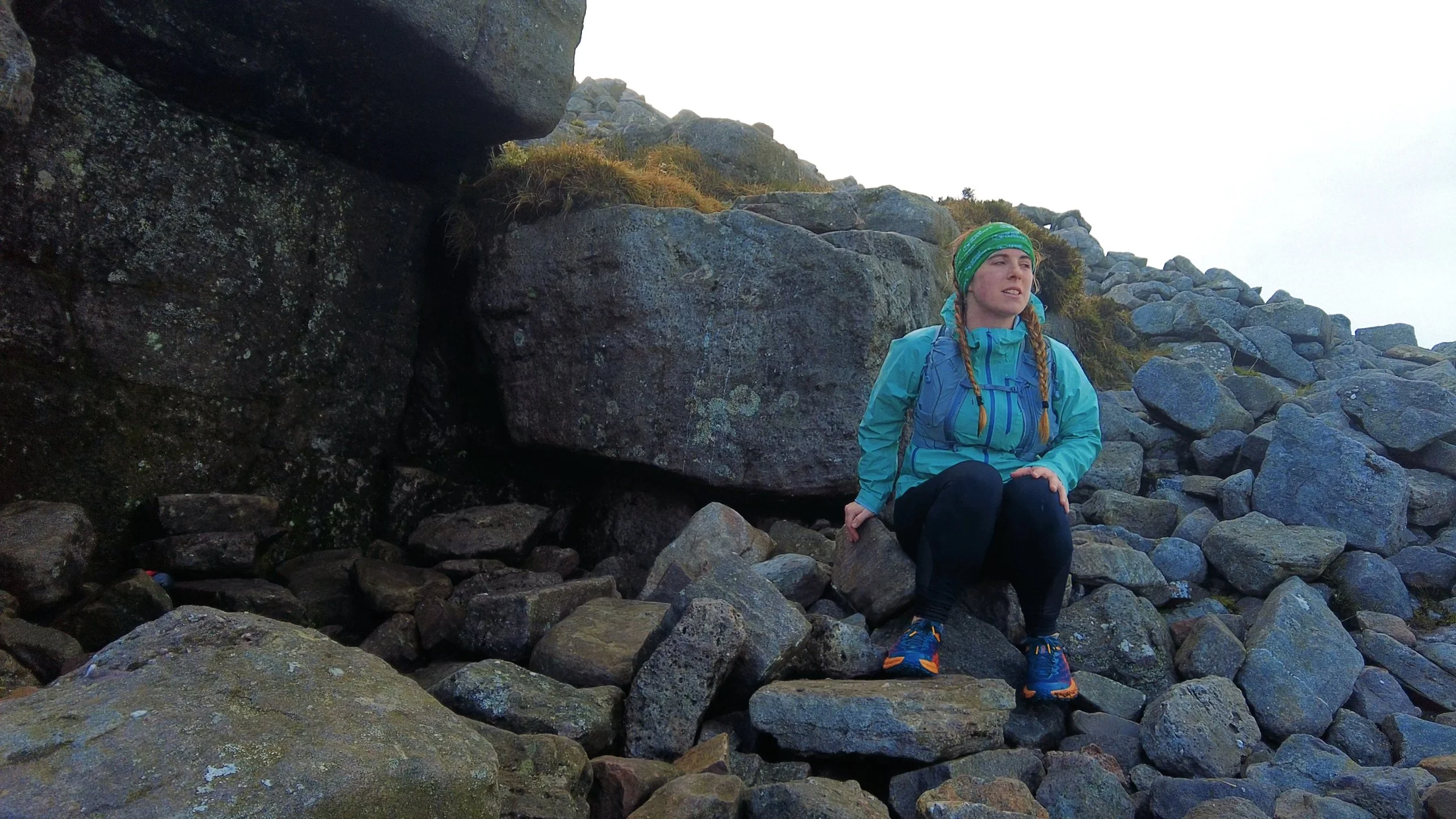
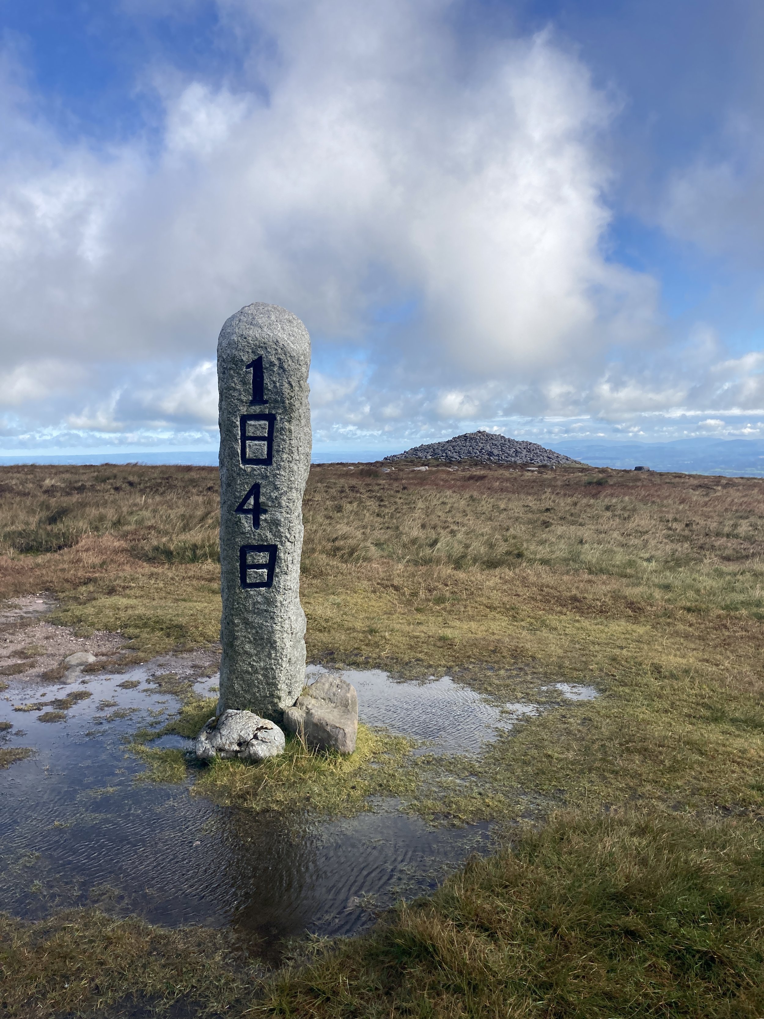
On the summit there are a few different markers - a trig pillar, an ancient burial cairn (with a natural rocky outcrop on its east side forming the appearance of a doorway), and a standing stone with the date 1848 emblazoned in a large black font.
The stone marks the 1848 Rebellion, when it’s said that 50,000 people assembled on the mountainside to hear Thomas Francis Meagher speak before he was exiled for treason.


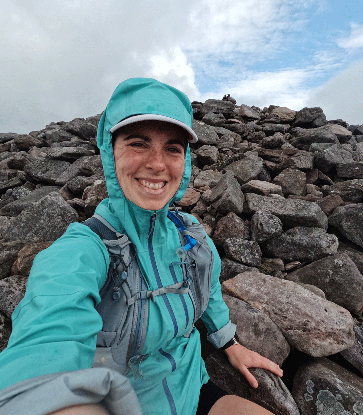
From the summit you can see the faraway Waterford coastline glistening on a sunny day. Overall, this is a lovely hike for all levels. Each time I’ve visit my family home, I’ve walked and run different routes across this mountain, and I know I still have plenty to explore. It’s an exposed hill, so be careful in bad weather and bring layers for the summit.
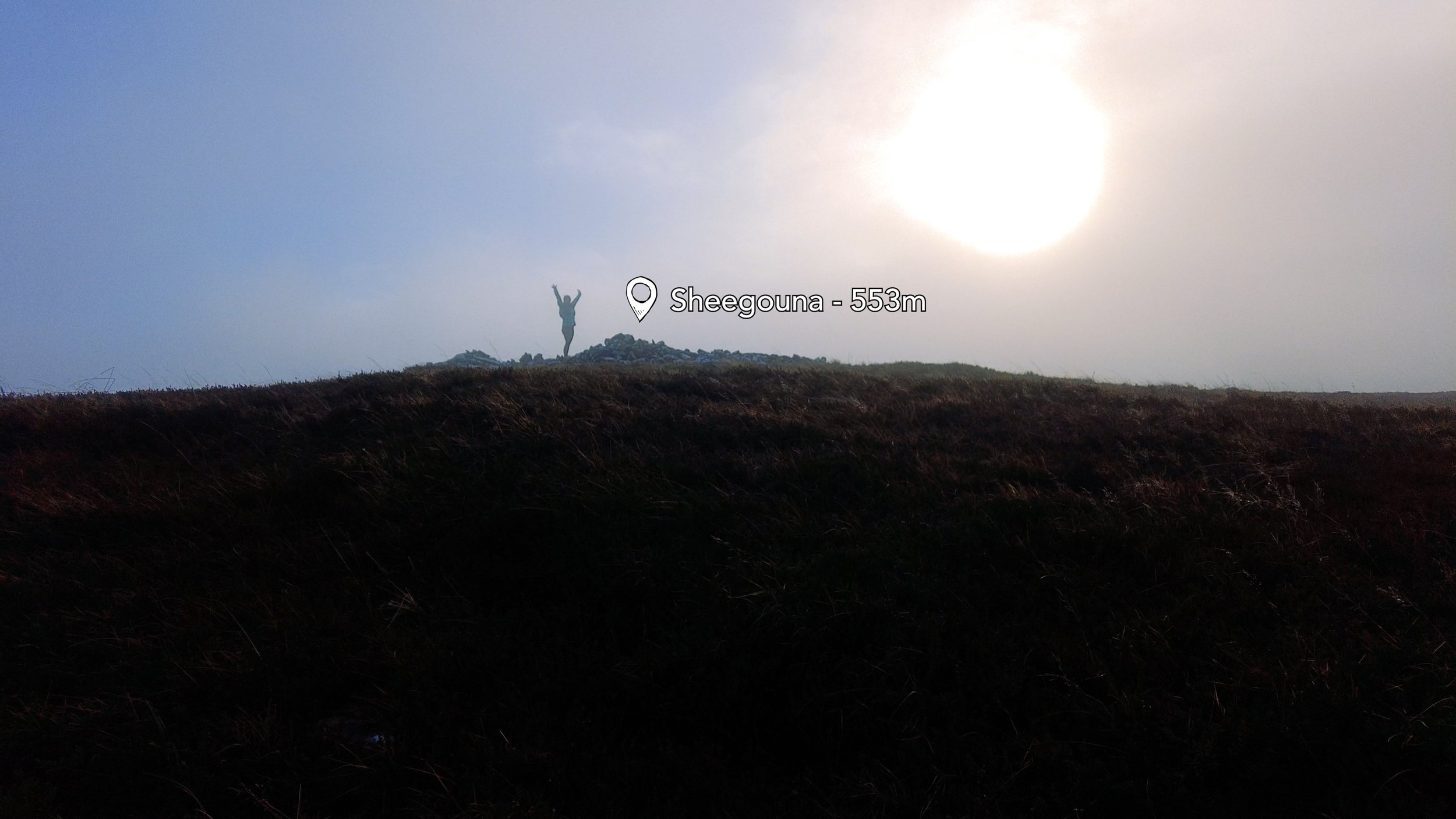
If you want to explore more than just the main summit of Slievenamon, there are three other lower peaks surrounding the main mountain; Slievenamon North-West Top; Sheegouna; and Knockahunna.
If you’re looking for inspiration, this route on Hiiker takes in Slievenamon and Knockahunna in an 11km loop.

My personal exploring has so far taken in Sheegouna:
Sheegouna is a small prominent point on the shoulder of Slievenamon. Starting off at the main car park, head up the same short lane. On reaching the top of the lane, turn right into the forest, following the old, overgrown trails. Using the edge of the forest as a guide, climb steadily upwards until you reach the far side of the forest.
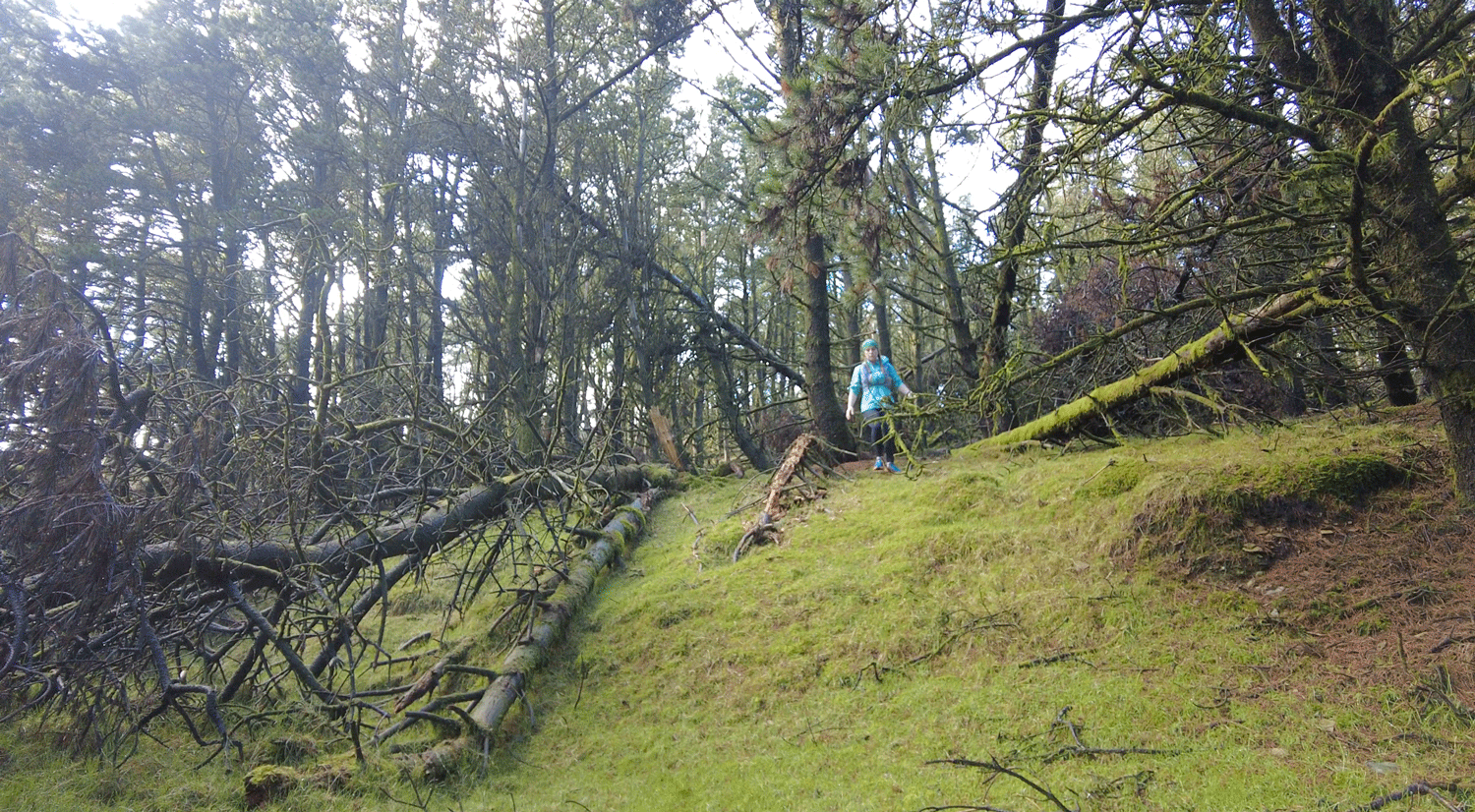
It’s then a case of tracking around the side of the mountain, maintaining as level a height as you can as you go. There may be few human trails through this stretch of heather, but there are plenty of winding sheep trails to hop between. This will take you to the shallow saddle between Slievenamon propper, and Knockahunna. Once you start to head in towards this saddle, take a sharp turn south (or left) to head up the side of Slievenamon/Sheegouna.
This small summit is a nice addition to climbing the main peak itself. From here I continued on up to the top of Slievenamon, and then down the established route. The total distance of this alternative route is 10km.