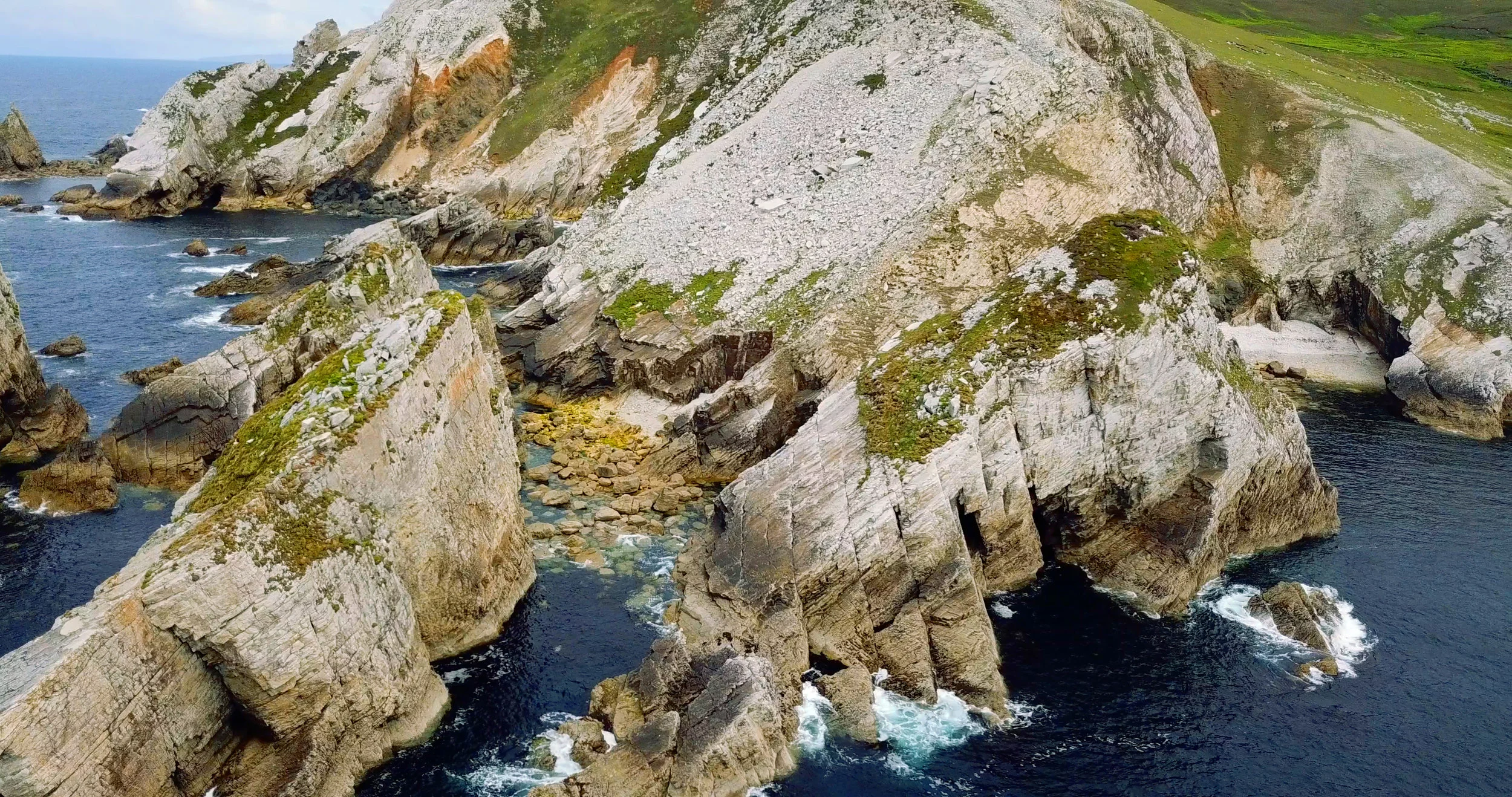
Our video of Port Beach, one of the most amazing places we came across on the Slí Cholmcille in Donegal.
This project has many faces : our youtube channel, the photos we share on Instagram, what we write about on this blog, and recently the Tough Soles Maps. I love all these aspects, but I realised recently that sometimes we’ll create and share something in one place, and then never mention it somewhere else!
At the start of this project, Carl and I bought a drone - a DJI Mavic Pro. It’s a very cool thing to have, and there were (and are!) many things we want to use it for. Carl loves history and heritage, and so one of his major reasons for getting a drone was to be able to see old tombs or heritage sites from a viewpoint that it had never been seen from before. I was excited to fly it over rivers and forests, alongside mountains, just completely enamoured with the beauty of nature.
In our main trail videos we don’t often use much drone footage, but it does appear every now and again. It’s even more rare that it gets a mention here on the blog, which is partially why I’m now writing this post! So here you will find links to all our drone-specific(ish) videos, and my feelings on having a drone.
Gougane Barra on the Slí Gaeltacht Mhuscraí.
This might be hard to believe, but quite often we feel like we’ve just forgotten that we have the drone in out bags, and have gone for weeks without taking it out, but when we do it’s always magical. We passed though Gougane Barra on the Slí Gaeltacht Mhuscraí during a snowy March. in the lake there’s a small island that is home to an ancient monastery that legend says was biult by saint Finbarr in the 6th century. The site is definitely ancient, with the current ruins dating from around 1700 when a priest called Denis O’Mahony moved to the island.

Miner’s Imagination - one of the many islands in Roscommon’s lakes.
A (unexpected) )common theme to our drone videos is … Roscommon! A beautiful county full of ruins on islands and thousand year old tombs sitting on mountainsides, we’ve really enjoyed our time walking there (this might be added to by the fact that Carl’s from Roscommon, so we always get to visit his family while we’re there, sleeping in beds and eating real food!).


Currently we have three drone videos from the Miner’s Way and surrounding area - The Carrowkeel Tombs and Lough Key’s Castle on an island.
I think partially have more drone footage of Roscommon because we don’t feel the time pressure of stopping and flying it - quite often on other trails we’ve not wanted to loose the hour or so flying takes - between setting it up, filming, and then packing everything away again. When our days are more flexible we’re more relaxed and take the times to do this.
Having said that, we’ve never regretted flying the drone, I think it’s just a case of reminding ourselves to actually stop!

With over 300km of walking in Donegal, we spent most of June 2018 wandering it’s wild and remote landscape. We put together one drone video of all the different places we went through: the Bluestack mountains, Bun Beg’s amazing coastline and ruined ship, Slieve Earagail (Ireland’s most striking mountain - it looks to majestic to be real!), and port beach.
The picture above is one of my favourite drone shots - we walking the Slí an Earagail, doing a long beach section between Bunbeg and Derrybeg. The Sun was setting after a day of blissful sunshine. And at the time, I had no idea that Earagil was actually visible from the beach, if you were high enough. It was just such an unexpected view!
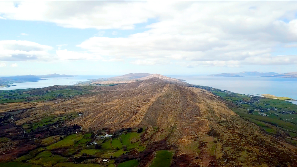
The Sheep’s Head Way brings you around the peninsula of the same name in north Cork. It’s a little south of Kerry, and just as beautiful. The hills aren’t high, but you feel on top of the world as you walk along the spine of the ridge line that weaves its way the length of the peninsula.

The Dingle Way needs no introduction. While we flew along its coast we got to look down on thousand year old settlements, stone farm walls that battle with the cliffs to fence in the land, and the beautiful blue of a restless sea.
We have noticed that drone content is surprisingly divisive; some people absolutely love it, while others dislike it quite strongly. I think going forward, if we include drone shots in our trail videos the best balance is a “tiny sprinkling”. While I may think every shot is beautiful, to hold people’s attention and keep them engaged it’s best to (try) and pick the two shots that speak the loudest to what we’re looking to say, and kill all our other darlings.

The floating boardwalk in Leitrim was a sight to behold when we walked there, making up our own little version of the Leitrim Way. This video isn’t exclusively flying shots, but the introduction is still pretty good!
Since getting the drone, I’ve become more and more aware of the impact flying has on those around us - both other people and animals. When we’re in a beautiful area, the last thing I want to do is possibly ruin it for other people. The drone isn’t a silent machine, as although we’ve bought special propellers to make it quieter, they only really work when the drone is quite high up. Nothing breaks the peace and quiet like the monotone droning of a drone. If you’re here to enjoy nature, why should you be interrupted by this noise?
And if we find the noise annoying, I can imagine that animals find it even more enraging, or terrifying. If we’re flying a drone to see amazing views of the nature around us, there’s not much point if we’re scaring it all away.
This problem is compounded by the fact that drones are very popular, and as more people buy them, the more of the sky we’re filling with little angry-sounding boxes …

One of our first times flying the drone, it was along the Royal Canal. In the more remote sections, where the path is still grass and spongy under foot, it’s amazing to see the concentration of life along the canals banks.
Thinking about the animals and and people we’re possibly effecting, should we even take it out of our house any more?
But then one of the main reasons we bought the drone was to be able to show people how amazing the less famous parts of Ireland are, and how much there is to love and explore here. So is it possible to use this medium as as promoters of being outside in nature? These are the kinds of personal quandaries that your mind falls down when you spend a long day walking and thinking. It’s easy to slowly, mentally pick over and chew these ideas for quite a while, and distill your own personal opinions down. For me, I think I still have some thinking to do on this topic.

Bay Lough near the Vee in Tipperary. Just down the mountain is the meeting point of the Tipperary Heritage Way, the East Munster Way, and the Avondhu Way.
Finally, I’d like to mention that our video of Bay Lough in the Knockmealdown Mountains is one of two videos that we’ve shared under the CC-BY-NC 4.0 licence, which means that people are free to share (copy and redistribute in any medium or format) and adapt (remix, transform, and build upon) this work, provided that they give appropriate credit (say that the footage is from Tough Soles, and link back to us!), and indicate if changes were made. There is more info on Creative Commons Licence here!
The second video we have registered like this is from Roscommon - we saw such amazing things there that Carl really wanted to share it.

Our CC-BY-NC drone video of Roscommon.
If you like our blog you can subscribe to it here!
If you really like it, you can support us on Patreon
Also, we now have a discount code for greatoutdoors.ie
it is TOUGHSOLES10 for 10% off 🌱