Official length: 68km
What we walked: 70km
Start point: Limerick City
End point: Dromineer, Co. Tipperary
Trail difficulty: 2.5/5
Trail quality: 4.8/5
Views/area: 5/5
Camping/accommodation: we were lucky enough not to have to camp for this trail! Thank you to our friends and family who put us up while we were walking this one.
I don't know if we saw many campsites on the lower half of the trail, but there were one or two spots on the top half! It would also be possible to stay in B&B's for the length of the trail, with Limerick city, Ballina, Dromineer, and many located along the lake.Maps: We’ve made our own Tough Soles maps! These maps are free to use, remix, and redistribute under CC-BY 4.0. All you need to do is attribute us! Here are the maps for the Lough Derg Way, and here are all the maps we’ve made.

21st May, 2018
It was a dark, drizzly Monday morning when we started the Lough Derg Way. It took us a while to actually start walking, hoping that we could wait the bad weather out. Two coffees and plenty of cafe loitering later we knew it was unavoidable, and so we made out way to the river. We found the building that used to be the Tourist Office, and could see where the old starting info board for the Lough Derg Way had been. There was still an Elvis pointing the way from there, and that’s all we really need this start walking.
The walk out of Limerick City is really nice - the first 5km or so link the city centre with the University of Limerick, and is well cared for. We met more runners, rowers, and speedy dog walkers along here than anywhere else we’ve ever been before.
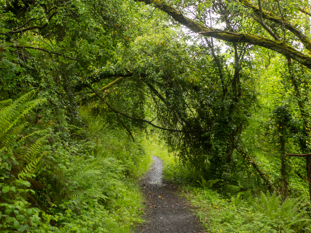
Once we passed UL the trail continued along small canals linked to the River Shannon. Less used, and less maintained, these trails were still a joy to walk along, and we wound our way through mystical green tree-arches and ivy doors. While rain walking isn't what I would usually think of as prime conditions, the consistent and dripping and misting did kind of suit the place. It felt lush and alive.
One of the bridges we passed when walking a small canal section was incredibly tall, having to deal with some high flooding in the winters. But what was particularly cool to see where the groves carved into the rock by the hundreds and thousands of ropes, pulled and dragged across, wearing the corners smooth - from back when barges laden with coal moved through these waters.

We briefly met up with the River Shannon itself - up on an embankment, channeling this huge body of water through to power stations and other water ways. It's pretty amazing that we saw the source of this monster when we were on the Cavan Way. I think I see this river as almost an old friend at this point; on of our first trail (the Royal Canal Way) we walked from Dublin to Cloondara, where we met the last set of locks that ferried small crafts through to the still but fast flowing Shannon; we started at Shannon Harbour and walked away from it on the Grand Canal Way; and we followed it's sunny embankments on the Hymany Way (where we both suffered from some mild sunstroke), and saw it flow into Lough Derg. It's also been a glistening line that we've spotted from many high points.
Eventually the magical rain turned into just plain old wet rain, and we decided to finish for the day - we'd made it out to O'Brien's Bridge, maybe 17km along the trail. Not a big day for us, but it was nice to know we'd made progress.


Waking up on day 2 the sun was out! We set out from O'Briensbridge down a couple of lanes until we reached the Shannon embankment again. What wasn't going to plan was the small black dog that had started following at an unknown point when we were walking the road, and wouldn't go home or leave us alone. Clearly, it walked this way very regularly as it showed us to the gate and up the small steep trail to the top of the embankment. Eventually, having gone back to the road, we gave out to it enough to have it stay behind. We both felt guilty as it turned its sad eyes in the direction of home. We walked with sheep beside big, loud dams, and marvelled at how these dams along the Shannon used to power so much of the country (the Ardnacrusha power plant was built in 1922, and at the time was the largest hydroelectric station in the world. By 1935, it was producing 80 per cent of Ireland's electricity).
When we made it to Killaloe/Ballina (each side of the river is a "different" town), we found a pub on the waterfront and sat in the sunshine. We ate some delicious seafood chowder, and sat there for a few hours, people and pup watching. Eventually the place started to get busy and we decided to relinquish our picnic bench.
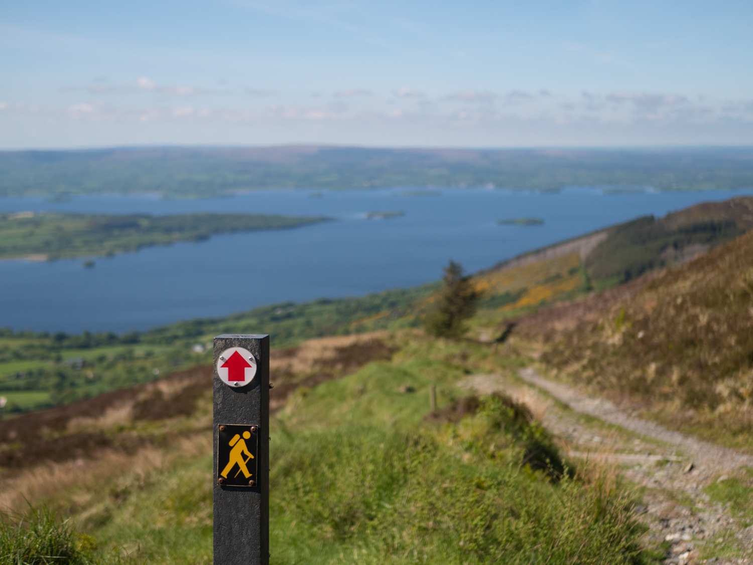
There's a relatively short road section out of town that winds up, and up, and up the hill. I'll admit, from the bottom I thought that this was going to be a hard climb. But the further we went, the more okay it was. It slowly moved to dirt tracks on boggy hillsides, and kept providing stunning views of the surrounding area. Somewhere along the way, Carl said that "as long as the trail keeps climbing, the rating keeps going up too".
The trail takes you to Tountinna Hill, and the remains of a mammoth concrete cross that was erected in the 1930s. However, the story goes that after a couple of years people pulled all the copper out of the lightening rod, and then the huge cross exploded when struck during the next storm. The remains still lie there, scattered across the summit. Since then, a large Millennium Cross, all slender and made of metal, has replaced it (around 2005/2006). Sitting up there in the sunshine we could see for miles.
The trail down the hill is a very long series of log and dirt steps cut into the ground. They were great to have, and even with their assistance my legs were tired at the bottom. I can imagine going up them is a whole other story. Around here we turned off and stayed with the amazing people of Derg Lodge for the night.


Day 3! Our final day on the trail.
As is usual with us, we had an unintentional late start. We made our way back to the trail and quickly pressed on. Crossing some really nice farm land, we took a break at a small access road. While sitting there, we heard someone practicing a bugle (we think)! It was so unexpected, and so we sat there in the small silent valley we were in and listened for a while. Seeing the sun move across the sky, and realising how late it was getting, we kept moving.
In our video of this trail we show "the callows"; a stretch of the trail fenced off from the main farmland (and built up I think to prevent flooding). It took us over an hour (almost 2hrs really) to work through this very tiny section because it was really really really, intensely, overgrown. At the end of the video, we're hurriedly filming a closing piece as we're exhausted and want to just be finished for the day. During it we say that the negative piece of the trail was that section, and otherwise it's a great trail. I think the fact that we highlighted the "bad section" resulted in our message getting lost in translation, and people paying more attention to that bad bit than to the 65 other amazing kilometres. So yes, we had a hard time there, waiting through chest deep thistles, and beating back nettles an umbrella. But it was also the middle of spring. Every living thing was exploding and growing. We were contacted just a few days later by the guys who work on this trail to let us know that both they, and the farmer, had been out working and clearing it all back. So I guess what I'm getting to in a long winded way; is that we deeply appreciate all the people who work on making these trails, and are involved in their maintenance, promoting, development, improvement - thank you. Thank you so much.
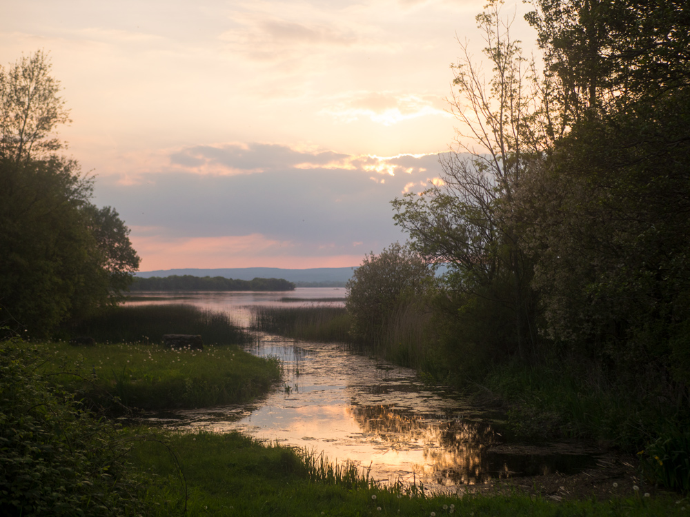
We want to share our whole experience, and if there is a bad trail (*cough* mid clare way *cough*), we want to share those highs and lows, but do that without hurting some of the trails we really liked. There was a meandering track along the lakeshore, and then a small road section into Dromineer to bring this trail to a close. We finished at dusk under deep pink skies, and meet up with our next amazing host.
Thank you to everyone who offered to have us while on this trail, you all made it extra special!


As I mentioned on the Slieve Felim Way, my bag had recently broken. Moving onto the Lough Derg way my back started to get sore from my wonky bag, and on the last day of the Lough Derg way one of my shoulders in particular was in a lot of pain - especially if I moved it too far, or into a different angle. My guess is that I was hunching or tensing my shoulders to stop the bag movement, which then tightened my muscles and left me gasping in pain if I bent to look through a fence.
We set off back to Dublin after this, and I went to in to Great Outdoors to figure out what had gone wrong. Thankfully they were able to send it back to Deuter to be assessed, and gave me a new Ospery bag so we could keep going!
If you like our blog you can subscribe to it here!
If you really like it, you can support us on Patreon