Having finished the north-east section of the trails (The Monaghan Way and the Tain Way), we decided to head south for a while for warmer weather and to tick off a couple of other short trails. Being a bank holiday weekend, our public transport options were limited, so we took the train to Limerick Junction. Limerick Junction has two trails starting at/near it: The Ballyhoura Way (89km) and The Multeen Way (23km). As we were arriving to the start of the trails late in the day, we decided it would be best to fly up the Multeen Way as far was we could that evening, finish it nice and early the next morning, and then hitchhike back the short 20km to start The Ballyhoura Way at lunch time. For an on-the-fly plan it felt pretty good.
The first 10km or so that evening we walked on busy country roads. Moral a little low from all the fast overtaking cars and angry dogs, we made it to the far side of Donohill and decided to stop for the evening when we reached a field full of energetic bullocks. Walking back a short bit we stopped at St. Jame's Well. There were some picnic benches on the side of the road, so we started cooking dinner. I swear, I don't know how we didn't cause a car crash. Every single person who drove past stared at us until their necks were about to dislocate from looking backwards so far. I guess these benches are never used.
Not wanting to cause further mayhem throughout the night, we decided not to camp there, instead asking a farmer if we could camp in his field. (The woman who answered the door wasn't as jovial as our first farmhouse encounter, and seemed very confused by the idea of us camping. I think just to get me to go away she pointed to the field beside the road and then closed the door.
The next day improved. The boisterous bullocks were dozing at the other end of the field so we passed unnoticed, and had our first few off road sections of the trail.
On the maps we got of the trails website it has a detour for our first bit of forest walking - of course, along road. We decided to check out the forest and see just how closed it was. When we arrived a very old sign said that there was logging going on, and while walking within the forest was still allowed there was extra risk being taken on by the walker. Seeing as that wasn't a hard no, we went on in. It only took us a couple of minutes to realise that this logging had happened years ago - the stacks of felled trees that hadn't been taken away already had knee high grass growing on it, and the trail hadn't seen tires in a very long time.
We came across a bench so decided to take a quick break. While sitting there, two huge birds of prey took off out of the trees and started circling the sky above us, calling out as the wound higher and higher. It was a pretty amazing moment. We think they were eagles, but we don't know for sure.
The forest section wasn't long, but a bit over grown, so we took our time. When we were exiting at one of the other entrences we saw a large warning sign, saying there was giant hogweed growing in the forest. We didn't need to study the picture to know we walked through it. Ireland doesn't have much in the way of dangerous stuff for us to come across, but this was pretty bad. If you get the sap on your skin, it burns and blisters - and the more sunlight you are in, the worse it burns. Not something we wanted. We just stood there staring at each other. It can react any time within 24hrs of getting on your skin. Being a warm day, we both hand t-shirts on. The plant grows from 2 - 5 metres tall, and we had waded through it for one section of the trail.
Thankfully, I can say that we got no burns of blisters. Some how. And really, I'm not going to question it, in case some magic plant god realises and snores is with it now.
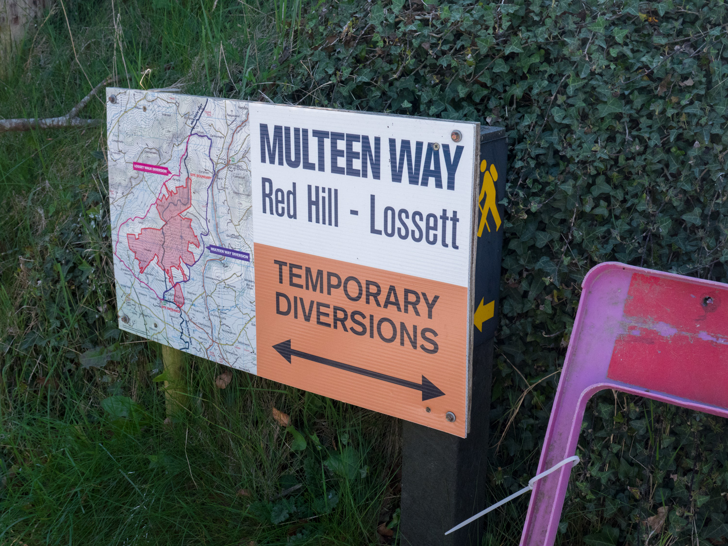
At early lunch time we arrived in Cappawhite. There was a big information board about the walk, which was great to see. But then we started reading. According to the information there the first 12-ish Km that we had walked to Donohill were not actually part of the trail. And that, from Cappawhite, the trail continues another 26km or so. There was a silver lining though - there was lots more forest and off road walking. So maybe finishing this trail would take us another 24hrs.
We then took 2 steps to the right, to the general notice board. On this board, it told us of a diversion to the trail, that saw the next 20 km be all along road. A wind farm was being build on the mountain where the forest was - or, had been. This called for a pick-me-up ice cream. We enjoyed our frozen sugar, and persuaded ourselves to get moving.
We walked less than 2 km out of the town along the diversion road. And came to a closed road sign. Up ahead of us we could see diggers ploughing up one side of the road. At this point I think I started laughing. There was another small sign giving details of this diversion, and another diversion. Carl walked through a field to see what he could see.
It is very nice that people did at least plot a diversion, and put up enough signs about it around Cappawhite to make sure we weren't at too loose an end. However, it's not much fun if you're walking on roads, and by then it didn't really feel like we were walking the trail any more.
So we called it quits.
It was easy and hard. Of course we want to stop for a day and do nothing. But once you've started something it feels like an even bigger failure to stop half way. I think we made the right choice, even if I'm still annoyed by it.
Below is the video we made of this half walk
Also, we have made our own Tough Soles maps! These maps are free to use, remix, and redistribute under CC-BY 4.0. All you need to do is attribute us! Here are the Multeen Way maps, and here are all the maps we’ve made.
The Multeen Way was days 15-16 of the Tough Soles project