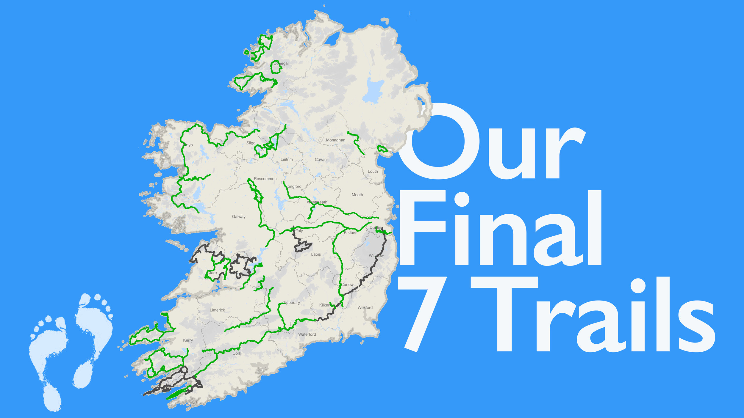
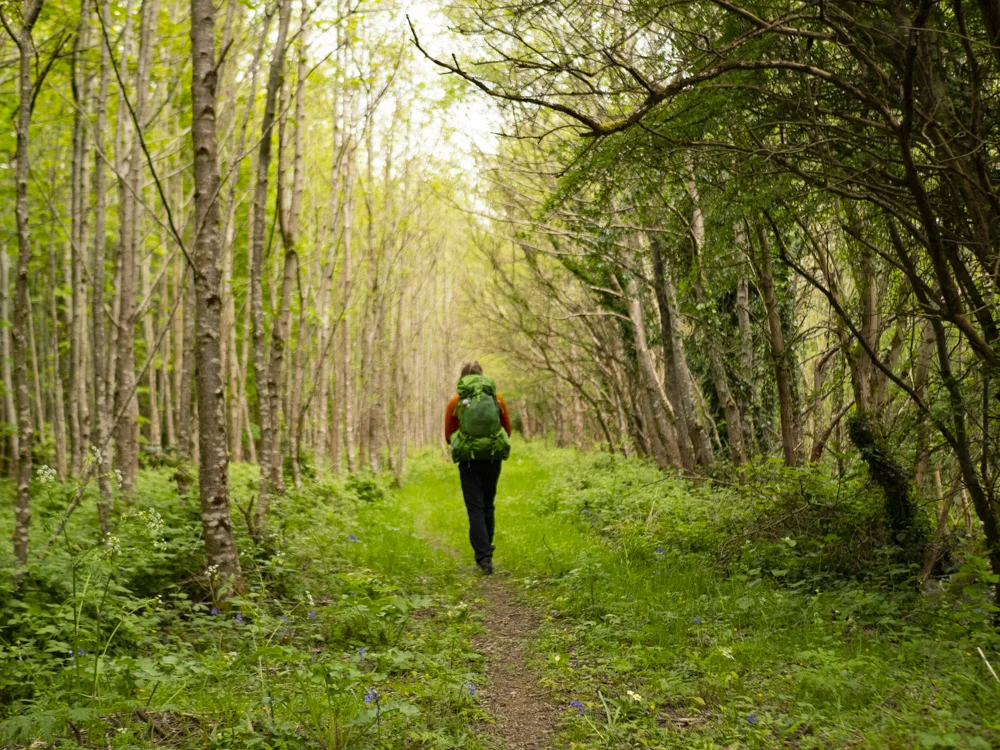
May has arrived, and summer is (slowly) starting to creep into the weather. The evenings are so long! And we’re getting ready to walk the final seven trails of the National Waymarked Trails. If you’ve been following this project from the beginning, you’ll know how much work this has taken us so far - broken feet, tendonitis, empty bank accounts, tears … but it’s also given us so much laughter, allowed us to meet and make so many new friends, experience beautiful moments in nature, and find so many new coffee shops!
The whole project has grown in such amazing ways, and we’re both incredibly excited to finish it. A while ago we sat down and made a video of us talking through the final seven trails we have left to walk, so here’s a companion blog piece to that video - just laying out some details so both you and I know what’s coming up over the next couple of months! The information listed below is just our initial research of these trails, so may not be correct all of the time.
Our final trails, in no particular order are …
The Offaly Way
The Slieve Bloom Way
The Burren Way
The East Clare Way
The Beara Way
The South Leinster Way
The Wicklow Way
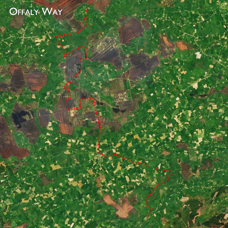
1. The Offaly Way
County: Offaly
Distance: 37km
Terrain details: According to the Irish Trails office, 17km // 46% of the trails follows local roads
Start/End points: Cadamstown - Lemanghan (Linear Trail)
Time: 1 - 2 days
Nearest large towns: Bir & Tullamore
Accommodation/camping: None that we know of yet, but the trail does cross the Grand Canal Way, which we have camped on in the past. Near the south end of the trail are towns such as Kinnitty that have B&Bs/Hotels, and along the trail is Kilcormac, which also has indoor accommodation options.
Maps: Here are our maps for the Offaly Way, and here are all our other maps.
Thoughts: It looks like this trail will be the easiest we have left, and probably not the most exciting. The trail takes us through a bog and along roads, with the Cadamstown end reaching the foot of the Slieve Bloom mountains.
We’ll probably do this trail first as a nice gentle way to ease ourselves back into walking.
*Spoiler alert! Since I started writing this blog post, we’ve gone and walked this trail! So yes, I can confirm that it was indeed our first trail back walking in 2019, and we had a great time. The Offaly Way blog post will be out next week…

2. The Slieve Bloom Way
County: Laois / Offaly
Distance: 70.5km, although quite a few sites quoted 60km?
Terrain: According to the Irish Trails office, 5km // 14% of the trail follows roads (Yay!)
Climb: 1275m
Time: 3 days
Start/End points: Circular trail, so possible start points include Glenbarrow, Cadamstown, Kinity or Clonaslee.
Nearest large towns: Portlaoise / Birr
Maps: Here are our maps for the Slieve Bloom Way, and here are all our other maps.
Thoughts: Looks like a really mountainous trail! We both have relatively high hopes for this trail - those that have walked it have only had good things to say, and with its remote nature we’re hoping for a couple of days quietly wandering around the mountains. The Slieve Blooms are one of the very few places where Coillte (Ireland’s major forestry company) have areas of forest that they allow wild camping! (more details on wild camping) The trickiest thing about this trail is how hard it is to get to via public transport. For somewhere that is geographically not that far away from Dublin (where we are usually based), I have a feeling that it might take as long to get here, as our most southerly trail in the county.

3. The Burren Way
County: Clare
Distance: 114km
Terrain: According to the Irish Trails office, 85 kms or 74% of the Way follows local roads.
Time: 4 - 6 days
Start/End points: Linear trail, going from Lahinch to Corrofin.
Nearest large towns: Lahinch and Ennis
Accommodation/camping: There are official campsites in Lahinch, Corrofin and Doolin! If you’re looking for indoor accommodation, there are countless B&Bs and hotels all throughout Clare so never fear!
Maps: Here are our maps for the Burren Way, and here are all our other maps!
Thoughts: Carl has never been to the Burren, and it’s been a long time since I was there. We’re both actually really excited for this trail, we think out of the three trails in Clare it’s going to be the best. There are a couple of extra off-shoots on this trail into different towns, so we’re not sure of our route yet, but we’re looking forward to this one!
We’ve actually tried to start the Burren Way before, but got caught in a lightening storm, leaving it for a later day.

4. East Clare Way
County: Clare
Distance: 180km
Terrain: According to the Irish Trails office, 95 kms or 53% of the Way follows local roads.
Total climb: 3060m
Estimated time: 8 days
Start/End points: This is a circular trail, with Killaloe listed as most people’s start/end point.
Nearest large towns: Killaloe, Ennis,
Accommodation/camping: This trail does pass through a number of towns so indoor accommodation should be feasable. Currently unsure of any camping options or hostels.
Trail heads: Killaloe, Broadford, O’Callaghan’s Mills, Tulla, Feakle, Flagmount, Whitegate, Mountshannon, and Scarriff.
Maps: Here are our maps for the East Clare Way, and here are all our other maps!
Thoughts: Currently, we’re a bit cautious of this trail. We didn’t have a great time on the Mid Clare Way, and one bitten we’re twice shy of this famous county. The large amounts of road walking listed for this trail have only compounded our fears, but we don’t want to slate a trail before we even get here. Some of our favourite trails are the ones that we had the lowest expectations of, so who knows!
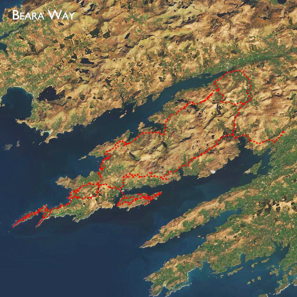
5. Beara Way
County: Kerry / Cork
Distance: 206km
Terrain: According to the Irish Trails office, 81 kms or 40% of the Way follows local roads.
Time: 9 days
Start/End points: Circular trail, with most people start/finishing in Glengarriff. It’s also possible to start/stop in Kenmare.
Total climb: 5245
Nearest large towns: Both Kenmare and Glengarriff are large towns, but the largest nearby town is Killarney.
Accommodation/camping:
* Hungry Hill Lodge & Campsite, Adrigole Bay (website)
* Glengarriff Caravan & Camping Park (details)
* Creveen Lodge Caravan & Camping Park, Lauragh (website)
* Beara Camping, north east coast of peninsula (website)
* Kenmare Hostel (website)Maps: Here are our maps for the Beara Way, and here are all our other maps!
Thoughts: This is the longest trail we have left, and a very close second to the longest trail on our total list! (loosing out to the Kerry Way). You might notice that I have 9 days listed for time on this trail, while we did the Kerry Way in 8 days. Yes, we could probably also do this trail in 8 or less days, but we were so tired after the Kerry Way that we know better than to squeeze it all in too tightly! So having a rest day in there somewhere would be really great. Otherwise, we’re just generally excited for this trail. It’s supposed to be just as beautiful as the Kerry Way, but a little less travelled, and a little more remote.

6. South Leinster Way
County: Carlow, Kilkenny, Tipperary
Distance: 104km
Terrain: According to the Irish Trails office, 58km // 56% of this trail follows roads
Start/End Points: Carrick-on-Suir, Co. Tipperary / Kildavin, Co. Carlow
Climb: 1490m
Time: 4 - 5 days
Nearest large towns: Carrick-on-Suir is a large town in itself!
Accommodation/Camping:
* Brandon Hill Camping (& Glamping), Graiguenamanagh (website)Maps: Here are our maps for the South Leinster Way, and here are all our other maps!
Thoughts: We’ve tried to start this trail many times, but for some reason it always puts us off (long road sections at beginning and end), and we’ve ended up going somewhere else. I don’t think this will be one of the highlights, but there will be a great section around the middle where is passes Brandon Hill, Inistioge and Graiguenamanagh - we’ve been there before on the Barrow Way!
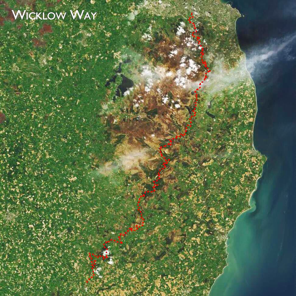
7. The Wicklow Way
County: Wicklow
Distance: 129km
Climb: 3,220km
Time: 5 - 6 days
Start/End Points: Marley Park, Dublin to Clonegal Co. Carlow.
Nearest large towns: well, you’re not going to get a much bigger “town” in Ireland than Dublin.
Accommodation/camping: There are three camping shelters on the western way - Brusher's Gap (Just north of Glendalough, it’s about a 90-minute hike out. It has a fire pit, a water butt (water may need to be treated) and a picnic table), Mucklagh, and Mullacor. There is also a youth hostel in Glendalough, and many, many B&B’s along the way, or tour walking groups that can organise accommodation for you.
Maps: Here are our Wicklow Way maps, and here are all our maps.
Thoughts: I know at the top of this blog post i said that these trails are in no particular order, there is definitely one order: the Wicklow Way will be last! The Wicklow Way will be our last trail because it was the first National Waymarked Trail, developed by J.B. Malone, Ireland’s pioneering trail developer. Originally, he dreamed of circumnavigating the whole island with connected, long distance walking trails. If you look to our overview map … you can see how that idea has developed over the last 40 years. I’m sure it’s not quite what he was imagining, but having around 4,000km of National Waymarked Trails on such a small island is a pretty massive feat within itself.
Most of the details on this page are based on the information available from the National Trails Office. We’ve found them to be good guidelines to use when we’re planning, but we never take these details to be a 100% guarantee - as the needs of land owners change and the landscape evolves, so do these trails. Always plan ahead and be prepared for things to no be as you expect!
Finally, if you know of any hostels, campsites, or really worth while visiting places that we haven’t mentioned along any of these trails, please do let us know! There is few things more powerful than local knowledge.
If you like our blog you can subscribe to it here!
If you really like it, you can support us on Patreon