The Avonmore Way is one of the newer additions to the Wicklow Trails Network, linking the villages of Laragh and Rathdrum through the beautiful Clara Vale Nature Reserve. This 12km linear trail is stunning when coming into spring bloom, right through to the colourful autumn changes.
Overview:
County: Wicklow
Distances: There are two different trail heads at either end of the trail, resulting in four possible distances:
Trooperstown to Stump of the Castle: 13km
Trooperstown to Hidden Valley Resort: 14km
Laragh to Stump of the Castle: 11km
Laragh to Hidden Valley Resort: 12km
Elevation Gain: 200m - 350m
Format: Linear Trail
Time: 2 - 4 Hours
Start / End / Parking:
Northern Trail Heads: Laragh Village or Trooperstown Car Park
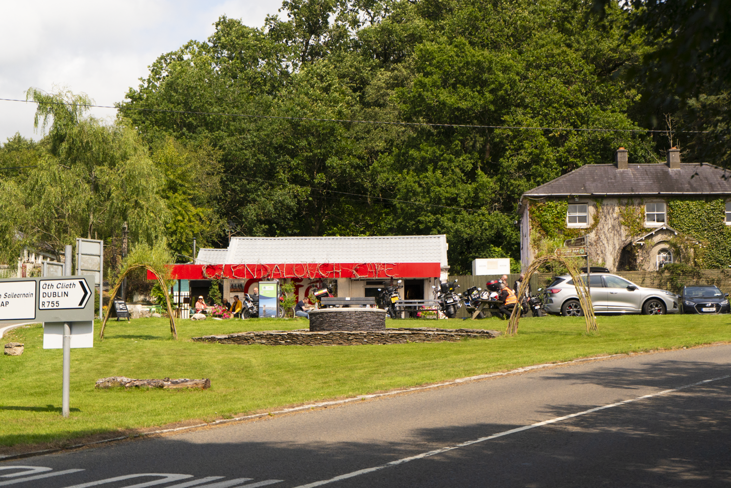
Just outside of Laragh Village there is the Laragh free car park, or there is some very limited on-street parking at the triangle around the Glendalough Cafe. The Trooperstown Car Park is large and free, with amble parking.Southern Trail Heads: Stump of the Castle or Rathdrum (Hidden Valley Resort)
There’s a small free car park at Stump of the Castle. At the Rathdrum end, there is on-street parking around The Mill Store.
Public Transport:
Rathdrum train Station, with trains from Dublin/Rosslare and Commuter Dart Routes
There’s a pre-bookable bus organised by WicklowWay.com
The Local Link connects Laragh / Trooperstown and Rathdrum (ad-hoc scheduling, planning required)
The Glendalough Bus / St. Kevin’s Bus links Dublin city centre and Laragh village.
Trail difficulty: Easy
Sticking to mostly small roads and forest tracks and trails, this is a quintessential Irish trail. It’s waymarked using Ireland’s official National Waymarked Trails “yellow walking man” way-marker (affectionately known to us as Elvis).
Read about trail grading in Ireland here.Trail quality: 3.5/5
Depending on your choice of route, the northerly section to Troopertowns Car Park can feel a little long on the road. When I walked there was some missing way-marking, which I think should be amended in the near future.Views: 4/5
A mostly forest-focused trail, with some views at the Trooperstown end. Lovely native woodland paths for the southerly section.Buggy/Wheelchair friendly: Not quite buggy friendly (maybe if you’re very determined). Not wheelchair friendly.
When did I walk this route: August 2025
Dogs allowed: No
External Links:
Starting off from the Northern end at Trooperstown, there is an info board tucked away in the back of the car park. From here, the trail brings you straight over to the Avonmore River that it’s named for, and which I’ll be following southwards all day.
The wide bridge (labelled Nolan’s Bridge on East West mapping), takes me across to the eastern bank, where the trail will stay until reaching the Samuel Haye’s Bridge down in Rathdrum. The way-markers follows a wide forestry road on a pretty consistent uphill (100m elevation gain) for close to 2km. It’s then another 2.4km along country lanes as the route skirts around the side of Trooperstown Hill summit. From this road section there are views towards Glenmacanass, Glendassan, and Derrybawn.
Something I noted on the day, and has been seconded by others, was how quite this road section seems to be. Wicklow, being as mountainous as it is, doesn’t have space for all that many roads. So in past experience I’d found that all the roads that do exist are used quite a bit. The morning I walked this I met one or two locals who were pottering about, and otherwise had the road to myself.
At the end of this section we come to the junction with the Laragh village off-shoot.


Starting from the free carpark in Laragh, it’s a shorter walk south. At the time of writing, this off-shoot is slightly trickier as the way-marking is patchy.
Leaving the car park head south, away from the village centre. After a hundred metres or so, take the lefthand turn. Follow the lane for about 400m, and then head into the car park of Ballard Woods. Keep heading south, away from Ballard Woof loop and take the forest track to the right - after about 600 - 700m, the trail joins with the Trooperstown route.


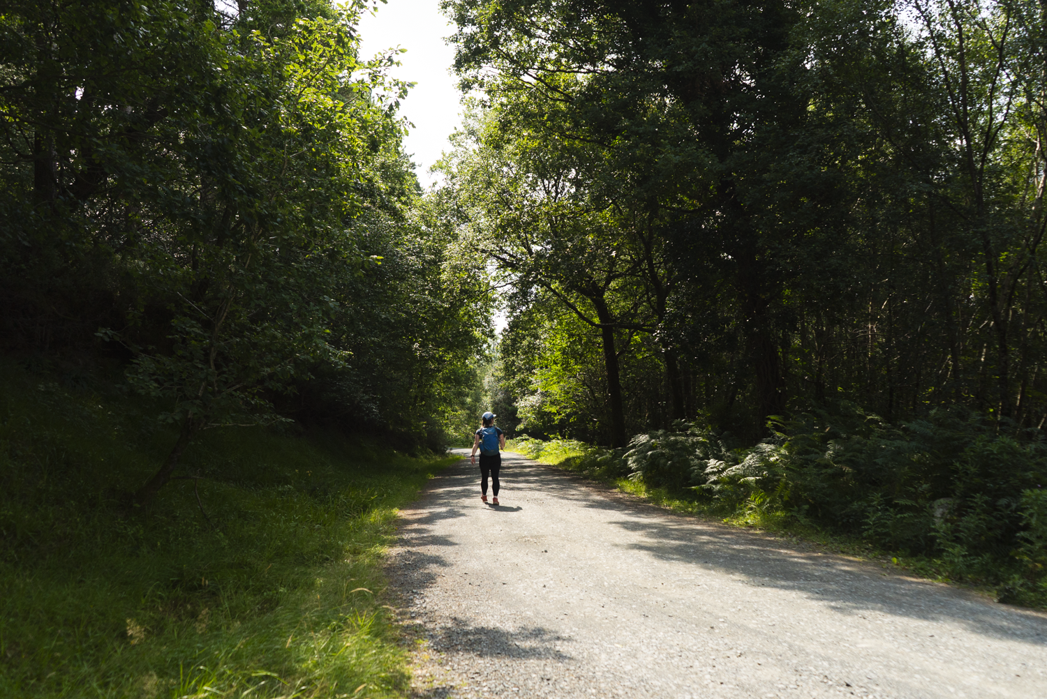
Now that we’re all joined up - it’s a pretty quite walk for maybe the next 3km. There’s an extremely straight forest road, some more winding lane, and then the trail begins to approach the Clara Vale.
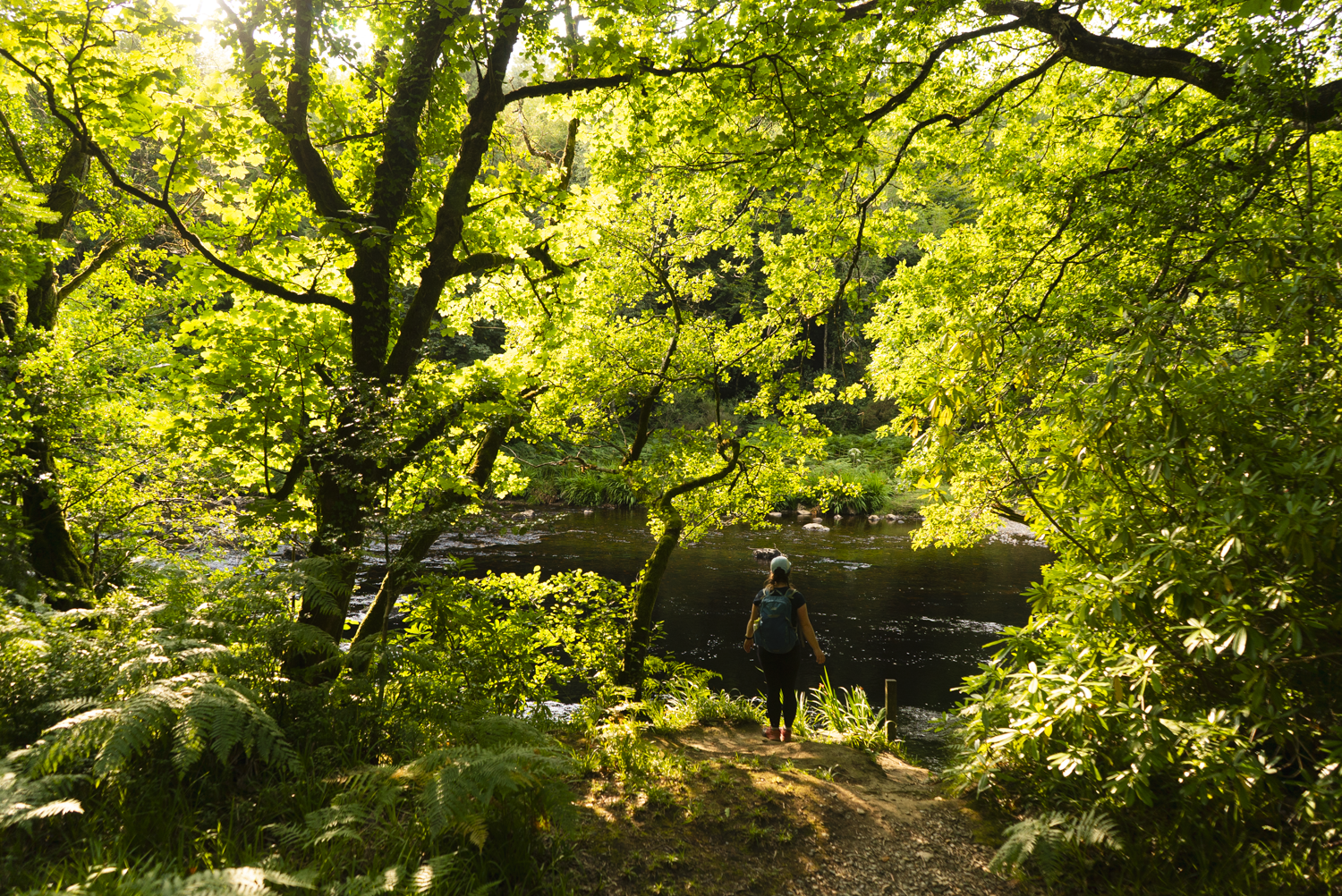
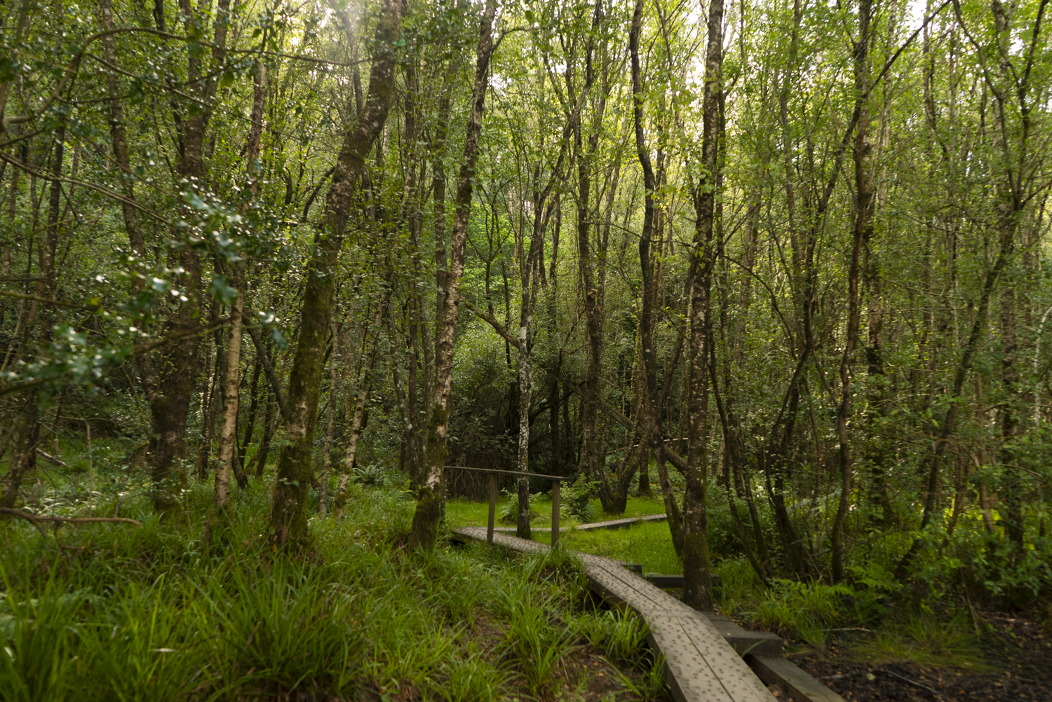
Descending off the road, there’s a lovely forest trail that brings us back along the Avonmore river once more. In the late summer sunshine, the water shone through the beach leaves, making the forest sparkle.


Unexpectedly, I found myself coming out at the back of a small church. The narrow pathway continues through the church grounds to the road, which the trail only follows for a couple minutes uphill to arrive to the main gates into the Clara Vale.
The Vale of Clara is the highlight of this trail. This nature reserve and the surrounding area is beautiful, filled with a variety of native flora and a true mixture of paths and trails. This nature reserve contains the largest area of semi-natural woodland in Co. Wicklow, and is potentially one of the largest stands of native hardwood in the country. As the NPWS website so dryly states, “the oak-woods are of high scenic value”.
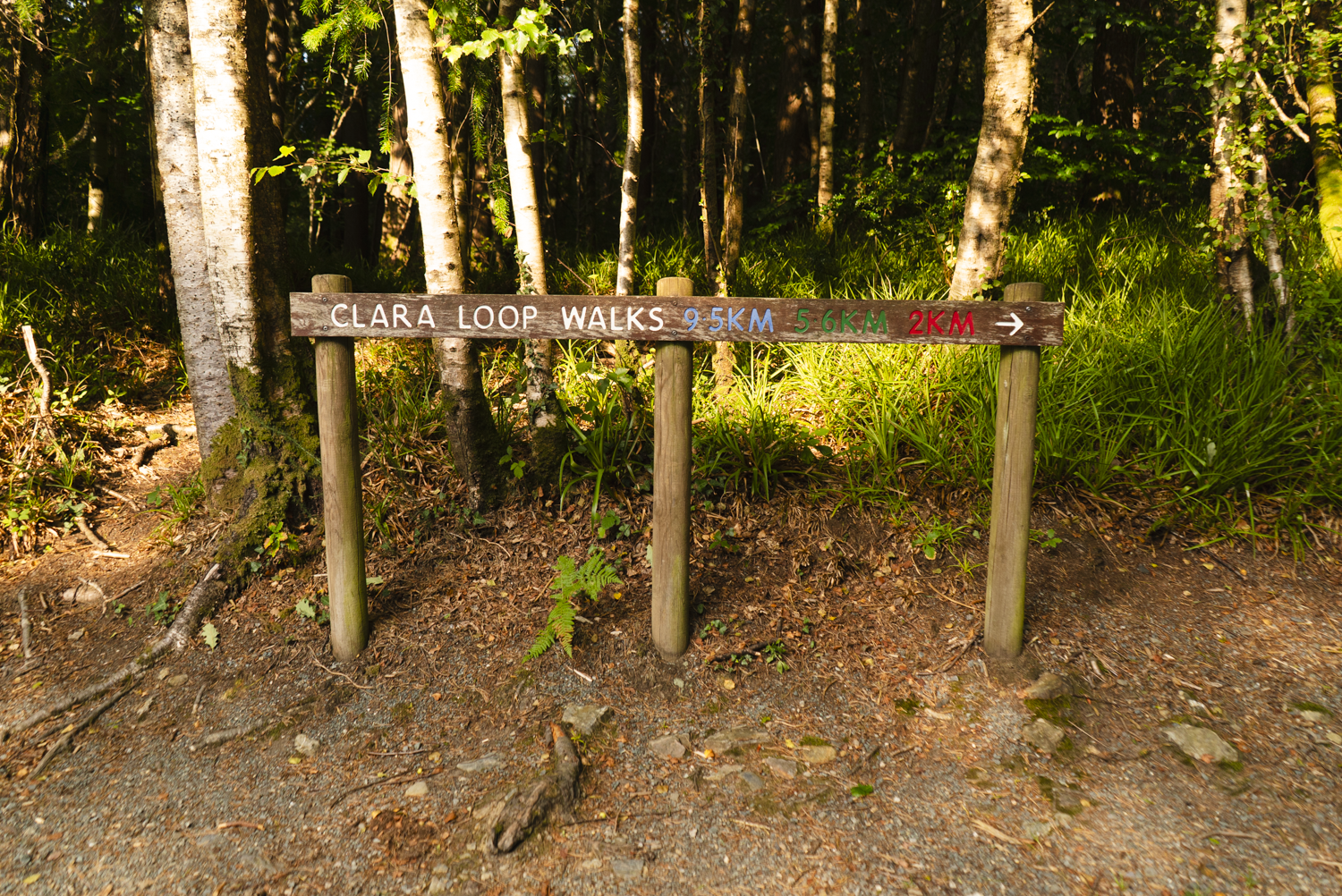


When the opportunity to walk this trail arose last winter, I chose not to - because I knew of this area. Walking and documenting these woods in winter would have felt like such a criminal move against the beauty of this place. There’s at least 3.5km of walking in this forest, before we come to our southerly trail junction.
Taking the turn for the Stump of the Castle is the shorter of the two options. Heading left and uphill, it’s roughly 800m to the car park. This was the original finish point for the trail, until the Samuel Hayes bridge could be built. It’s still a fine finish point now, but I think misses out on some lovely trails.


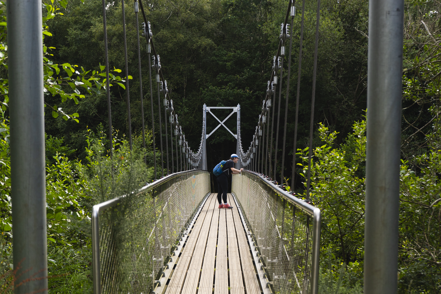
Keeping right and heading towards Rathdrum, there’s probably a mile left to the walk, but with lots of highlights. The first being - the suspension bridge.
Samuel Hayes was an 18th century member of parliament, commissioner of Avondale House, and lover of trees. At a time when native forests were fast disappearing, he believed the future lay in reforestation and managed woodlands. He wrote Ireland’s first book on trees - a practical guide on planting, managing timber, and the estates around Ireland that were home to trees of note. According to Wicklow Heritage, all of the oldest trees surviving on the Avondale estate were planted by Hayes. Not to mention, he also designed a pedestrian single-span bridge for this very river!


After the bridge, the way-marking again becomes a bit patchy, so here are my directions until the way-marking is updated. After the bridge, turn sharp right and head back upstream. At the next Y-junction, turn hard left and slightly uphill. Keep left at the next junction, and follow the trail around until you reach a bench with a “Jubilee Loop” way-marker. Follow this left through the next lovely little section of raised boardwalk, along the edge of the rugby club, and to the entrance to the Hidden Valley resort. Here you’ll find the Rathdrum info board, and the end of the trail!
My personal favourite configuration for this trail is to walk from Rathdrum to Laragh (or the reverse).
Thanks to Bryan for all the work he did years ago to get the Samuel Hayes bridge into production - I’m imagining it was a huge project to connect the trail directly to the village with a bespoke footbridge. It not only makes the trail far more accessible to walkers who don’t drive (or don’t have two cars to leave at either end), but it also brings the walkers into the local community, meaning that the community is more likely to benefit from the walking tourism. I know from my own experience, and having watched other walkers for many years now -when you’re travelling on foot, you’re highly unlikely to make a detour that’s going to add more than a couple of hundred meters to your route. So if you want a community to benefit from walkers, you have to make a really appealing route into the village. This trail ends outside of the main village centre, but it brings you to within the visual bounds of the town (eg. footpath, built up surroundings), meaning that you already feel connected and will continue onto a shop or coffee shop. More Irish trails need this thought and consideration.

As I’ve highlighted before, the fact that this trail is connected to the train line (Rathdrum) is a huge boon. An alternative “Wicklow Way” adventure could be to take the train to Rathdrum and walk the Avonmore Way up to Laragh or Trooperstown, joining onto the Wicklow Way easily from either northern trailhead. What I’m imagining is:
Day 1: Rathdrum Train Station — Brushers Gap Hut
18km | 520m elevation gain | via Laragh Village
Day 2: Brushers Gap — Glencree River
23km | 770m elevation gain
Day 3: Glencree River — Marlay Park
20km | 625m elevation gain
Further exploring
Other day hikes in the area:
Nearby National Waymarked Trails:
Mountain Hikes:
Coffee/food options:
Glendalough Green Cafe, Laragh: a Wicklow institution, I’ve been going here since before I could walk! this is the perfect cafe for a cosy mocha on a winters day, or a coffee and sweet treat to take out into the sunshine of a summers day.
N11 Avondale - Restaurant in Rathdrum
Pitstop Coffee - takeaway coffee in Rathdrum