Knocknarea & Queen Maeve’s Trail
Knocknarea is one of Sligo’s most iconic peaks. Sitting on the south-west corner of the bay containing Sligo Town, this hill is small but mighty. While there have been walking routes around and across Knocknarea for years, it was in 2015 when the current trails were put in place. The route is now known as Queen Maeve’s Trail; named after the legend that the huge cairn and tomb on the summit of the hill is her resting place.
I’d walked and run this route several times since moving to the North-West of Ireland, and it’s still one of my favourite spots to go for a couple of hours of energetic walking.
Overview
Distance: 8km
Time: 2 - 3hrs (depending on route and fitness)
Parking:
Car Park A: Sligo Rugby Football Club (€2 optional parking donation)
Car Park B: Coillte Rathcarrick Car Park (Free)
Car Park C: Knocknarea Southern Side Car Park (Free)Trail difficulty: Easy
The trails on Knocknarea are very clear, with signposts at junctions for car parks. However there are one or two sections that can become very slippy when wet - this is mostly on the south-west side of the hill, on the climb/descent from the hill’s summit to car park C.
I’ve already called this hike “small but mighty” in the opening paragraph. Knocknarea is a hill with very steep climbs. The steepest sections are from car park A to the summit.
Learn more about trail and hillwalking grading here.Trail quality: 5/5
The trail is really well defined, but still feels like a trail. It changes surface / material every so often which keeps you mentally engaged and thinking about where you’re going.Views: 5/5
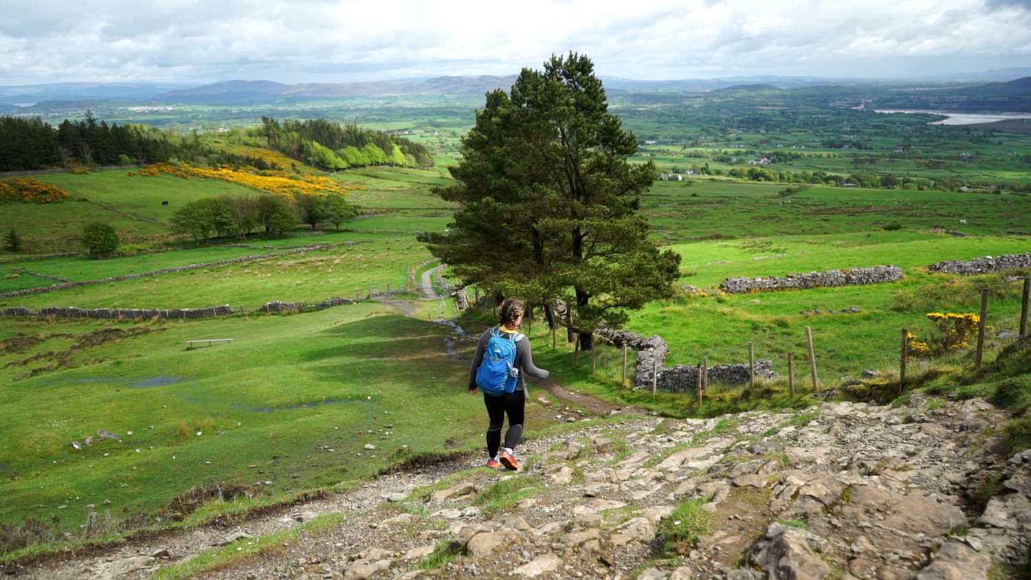
I think for the area that it is, you couldn’t get nicer views!Buggy/Wheelchair friendly: No
If you’re looking to get to the summit, this is not a accessible route for buggies or wheelchairs. However, if you’re looking for some general trails for a shorter walk, there are options here. The trail from car park B - C is the most accessible section: it has one or two steep sections, and a kissing gate at the forest entrance closest to car park C. I’m pretty sure the trail is then unobstructed until the kissing gate at the top of the climb from the car park A / The Rugby Club.Dogs allowed: No
The whole top half of Knocknarea is farmland, and every time I’ve been I have seen sheep. There is explicit signage asking for no dogs on the hill.
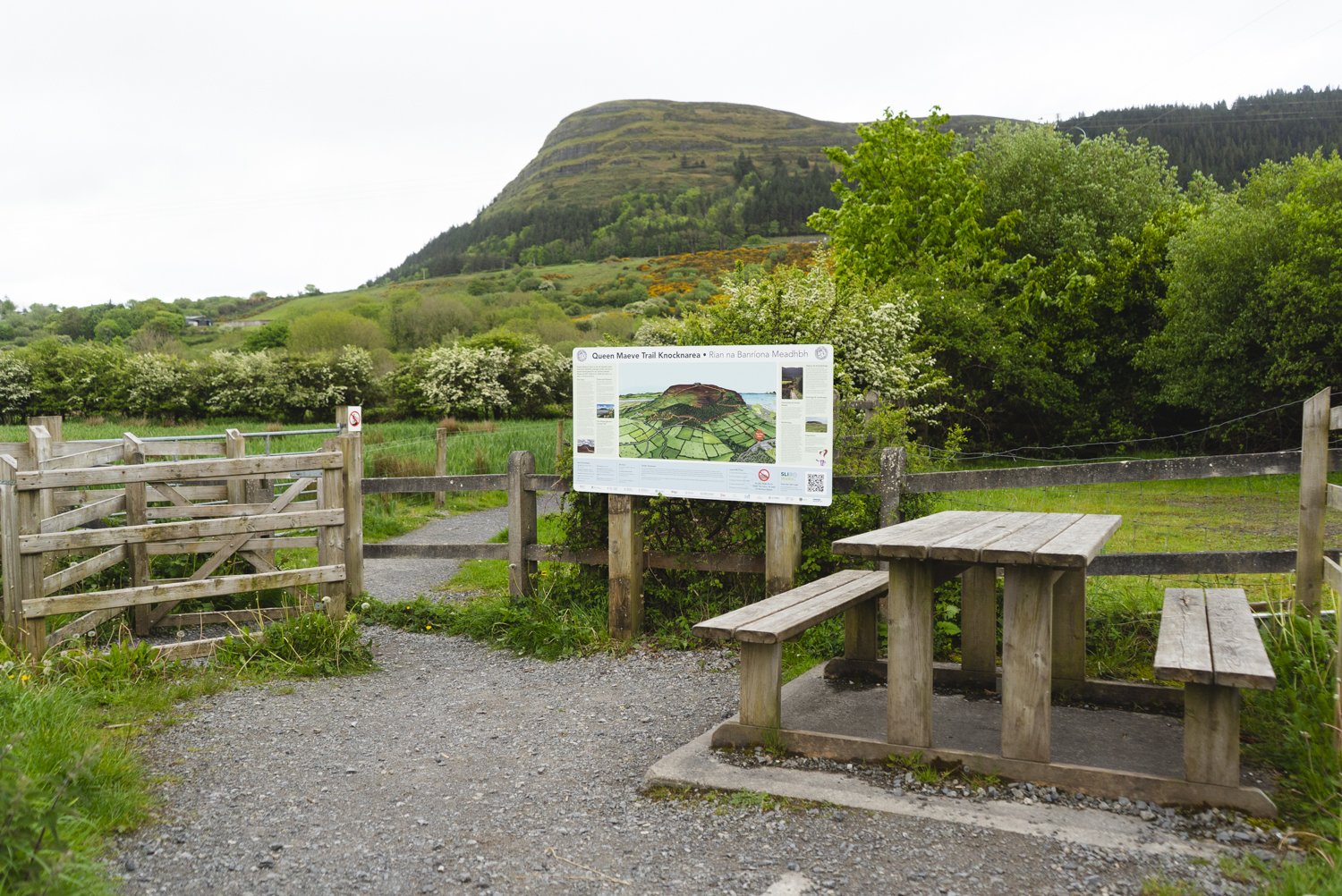
My usual starting point for this hike us the Sligo Rugby Football car park in Strandhill (marked as Car Park A on the map). This car park is the closest to sea level, and so will have the most climbing - if you’re looking to get as much elevation gain as possible, it’s a good spot to start at. From here to the summit is about 2km, and the trails climbs a little over 300m.
Setting off from the trail head, the path is fenced off from the surrounding fields with gravel underfoot. After a couple of minutes of gentle climbing, the path becomes a staircase. This is the first of the two main climbs from here to the summit. These steps can feel long - if you do struggle, there’s a bench a bit over half way up. It’s a great moment to look out across the bay to Sligo’s other famous peak: Benbulben.
On reaching the signpost and kissing gates at the top of the steps, you can go left or right. Right brings you up to the summit, and on the loop that I’m walking, I’ll be coming back from the left path. The rolling gravel trail give a moment of reprieve, skirting the bottom of the forestry. After a few hundred meters, the trail turns back uphill and into the woods, moving onto bog-bridge (aka board walk or raised sleepers). This is the second major climb from this side. As the bog-bridge switches back and forth through the forest, it’s easy get mentally lost in the lines of trees, and not realise you’ve reached the end of the climb until daylight appears ahead.
On a sunny day, I love how the light plays through the trees, lighting up the vibrant mosses near the bog-bridge. Once out onto the hillside the path returns to grass and gravel, the ascent slowing as the trail makes the final few hundred meters across the plateau summit to Queen Maeve’s Tomb - the massive cairn that you can see from miles around.
The trail that loops around Knocknarea is known as Queen Maeve’s Trail - an Irish warrior queen from over 2,000 years ago. She was the Queen of Connacht, and the myths that surround her are as wild as the west coast landscape. One of the most famous stories of her life is about the Brown Bull of Cooley. It’s a tale of power; where Queen Maeve steals the Brown Bull of Cooley from Ulster in order to equal her then husband's wealth and his white bull of Caunnacht.
It is said that when Maeve died, she was laid to rest atop Knocknarea, standing upright, spear in hand, facing her enemies in Ulster. The cairn on top of the hill is certainly big enough to have buried Maeve in such a way - the enormous stone mound is over 10 meters tall, 60 meters wide, and is estimated to be made up of 30,000 tons of stone.
The stone monument on the summit is one of Ireland’s most iconic neolithic sites, and is dated to be over 5,000 years old (so centuries Maeve would have walked the land). One of Ireland’s best kept passage tombs, the myths that surround this tomb are said to be partially why it has never been excavated by archaeologists – such is the fear of Queen Maeve’s wrath.
All along this trail you’ll find info boards and QR codes that tell of Queen Maeve’s life, her role in An Tain, and the stories she’s inspired since. They’re all small and blend in nicely with the area, providing the information for those who want it without overpowering the rest of the experience. The illustrations they have are also gorgeous.
We’ve even encountered Queen Maeve’s legacy in the trails we’ve walked before. The third trail we ever walked as Tough Soles was The Tain Way, a 40km trail that loops around the Cooley mountains, where she stole the brown bull from, with the very trail being named after the cattle raid.
Leaving the summit behind, the path becomes a less defined trail, with route worn down to the underlying rock. When wet this section can be quite slippy, but otherwise it’s a gorgeous descent to the the farm gate. Slipping through the kissing gate, follow the small farm lane down to car park C.
This car park has seen the most development in recent years, and I know that on certain days there is a coffee van here! To keep following the loop, you have to walk down into the car park to the Yeats Trail statue and then almost double back on yourself along the trail beside the field.
The trail from here can almost be called flat - there are a few climbs as we loop back around to car park B, but all of them are short. The gravel path twists in and out of the mixed woodland, opening up to views of the Dartry Mountains, Union Wood, and Lough Gill.
You’ll come to a sign for car park B, the final car park! You can take the right turn descend down to the car park if you’re looking to include as much elevation as possible (it’s also quite a pretty trail), or you can keep left and stay above it. The car park is a standard Coillte gravel car park.
The final section from car park B to the top of the original split is in mostly through predominantly Sitka Spruce forests, but is still a lovely trail. There is one final hill in the route before you reach the top of the stairs back down to car park A (The Sligo Rugby Football Grounds), just to make sure you’ve sweat while out!
Rating the difficulty of this trail is rather tricky, as the path is very clear and defined. However, there is a lot more climbing on the route than you’d expect, and can feel quite strenuous. I don’t have any worries of someone getting lost, but definitely allow yourself some time for the 6 - 8km, and bring some water/snacks!
I love this trail, I think for such a small area it offers so much lovely walking. I know I’ll be back many more times.
Further exploring
Other trails in the area:
Mountain Hikes:
Favourite Local Coffee / Food Options:
Shells of Strandhill
Rover Coffee Lab, Sligo


